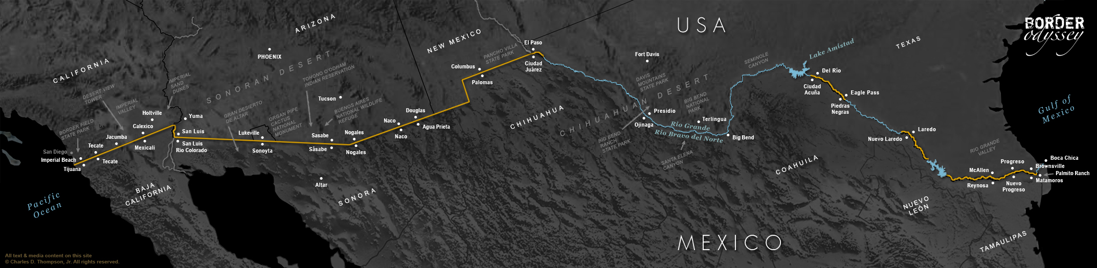
Note: Click on any photo below for more info, including audio clips and additional photos. The locations below are in order from East to West.
Boca Chica
Boca Chica

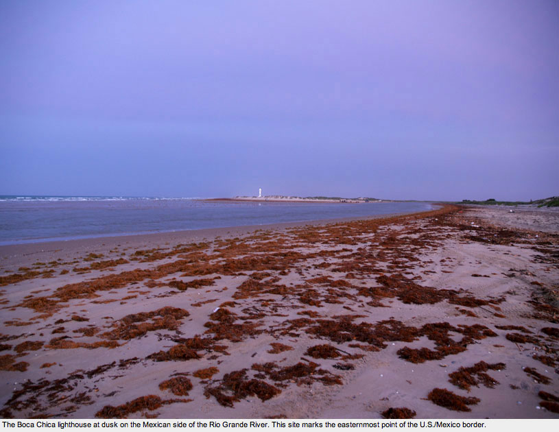
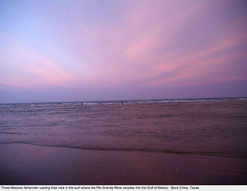
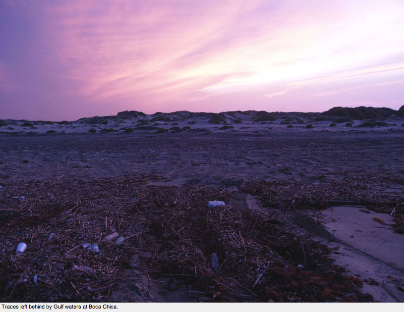
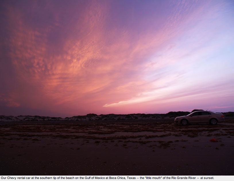
Boca Chica is the easternmost point on the border between the United States and Mexico. It is located on a sandy peninsula separated from Mexico by the Rio Grande River and detached from South Padre Island by the Brazos Santiago Pass.
One reaches the Boca Chica beach by taking Route 4 eastward from Brownsville until the road ends.
Going south from this point, one can drive to the Rio Grande/Bravo and see the lighthouse on the other side of the river in Mexico. Though technically a state park, there are no facilities, houses, or border markers of any kind within sight.
This is where Hope and I began our Border Odyssey.
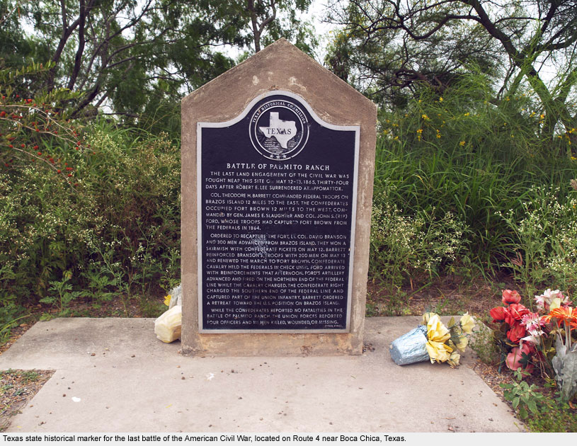
Palmito Ranch
Palmito Ranch
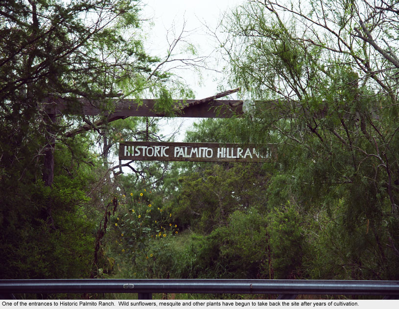
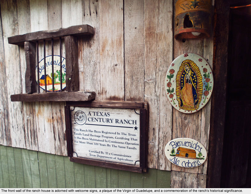
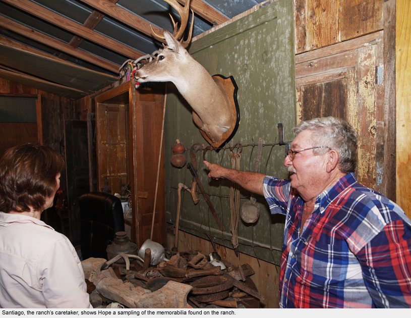
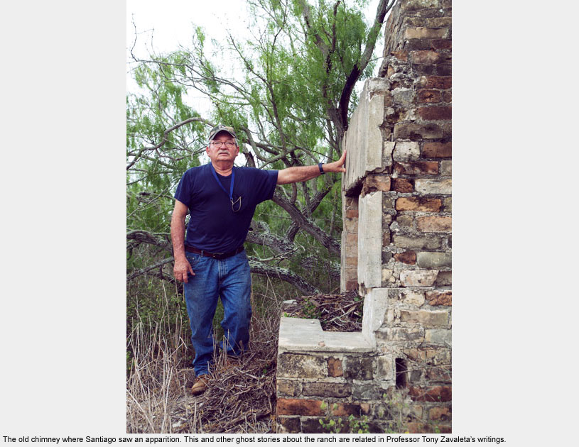
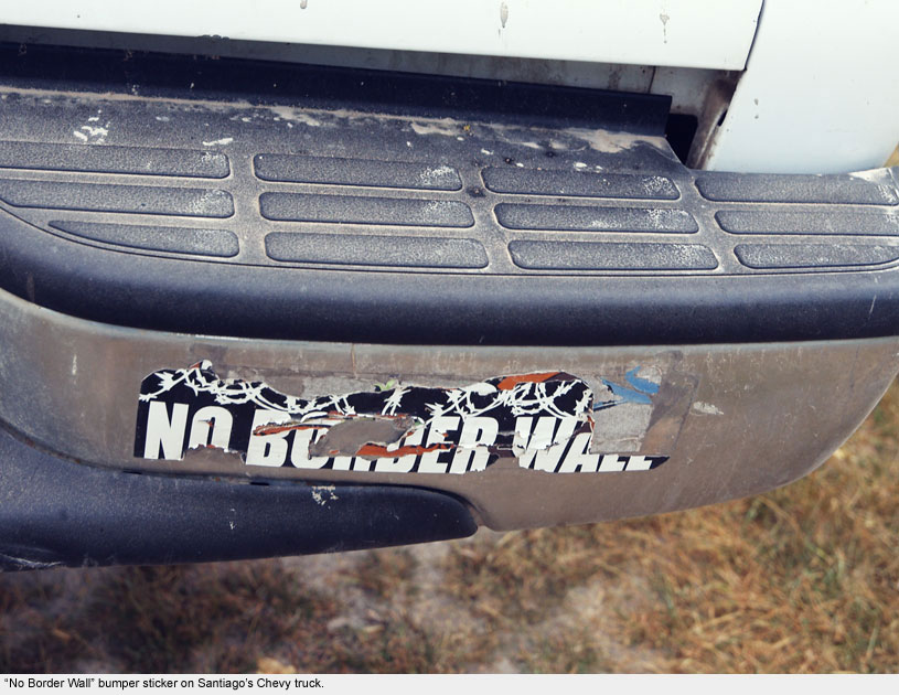
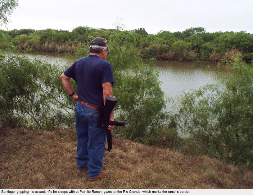
Palmito Ranch, located just west of Boca Chica near Texas Route 4, is the southernmost ranch in the United States.
Owned by Professor Tony Zavaleta’s family for well over a century, it is located on the Rio Grande River just a stone’s throw from the state of Matamoros, Mexico.
The ranch was the site of the last battle of the Civil War, fought nearly a month after Lee’s surrender at Appomattox in 1865 as Maximilian’s soldiers looked on from the Mexican side of the river.
Once a working ranch with horses, sheep, and goats, the land today is idle and the ranch house serves as a family camp where Hope and I were privileged to stay as guests for a night in May 2010.
Brownsville – Matamoros
Brownsville – Matamoros

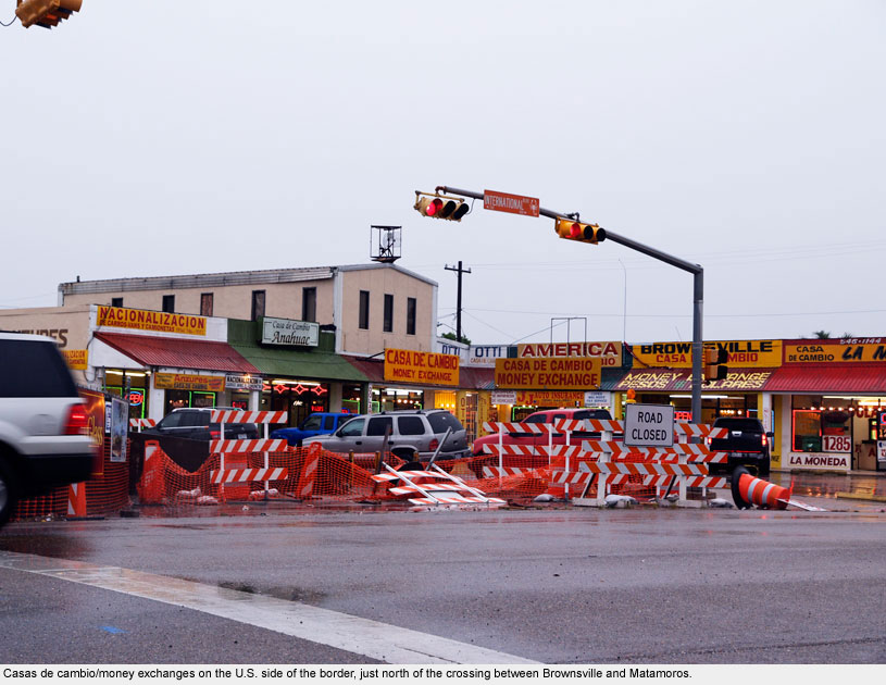
Brownsville, a major border crossing into Matamoros, Mexico, was originally the site of Fort Brown, a military outpost that played a significant role in both the Mexican-American War and the American Civil War.
Today a golf course covers historic Fort Brown, leaving it undeveloped as a tourist site. In fact, reports say that taking photographs on site is prohibited, and hitting a golf ball from the sixteenth hole into Mexico results in a fine.
Brownsville is home to the University of Texas at Brownsville and Texas Southmost College.
Controversially, the border wall was proposed to cut through the campus as a result of the Secure Fence Act of 2006. This plan prompted protests and a lawsuit from faculty and students, which pushed the site of the wall further south.
Fort Brown and the golf course remain south of the fence.
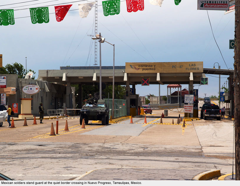
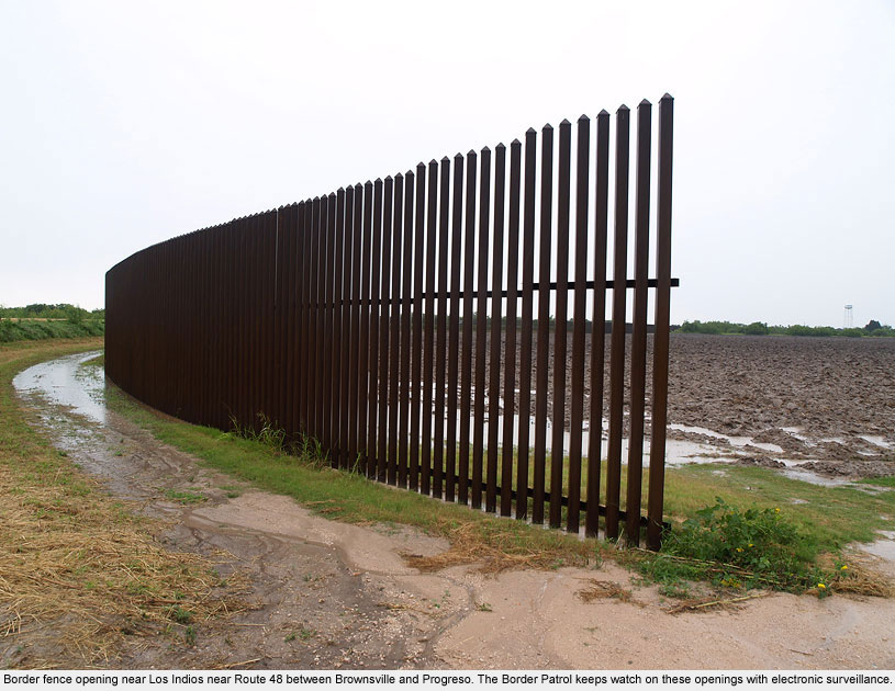
Progreso / Nuevo Progreso
Progreso / Nuevo Progreso
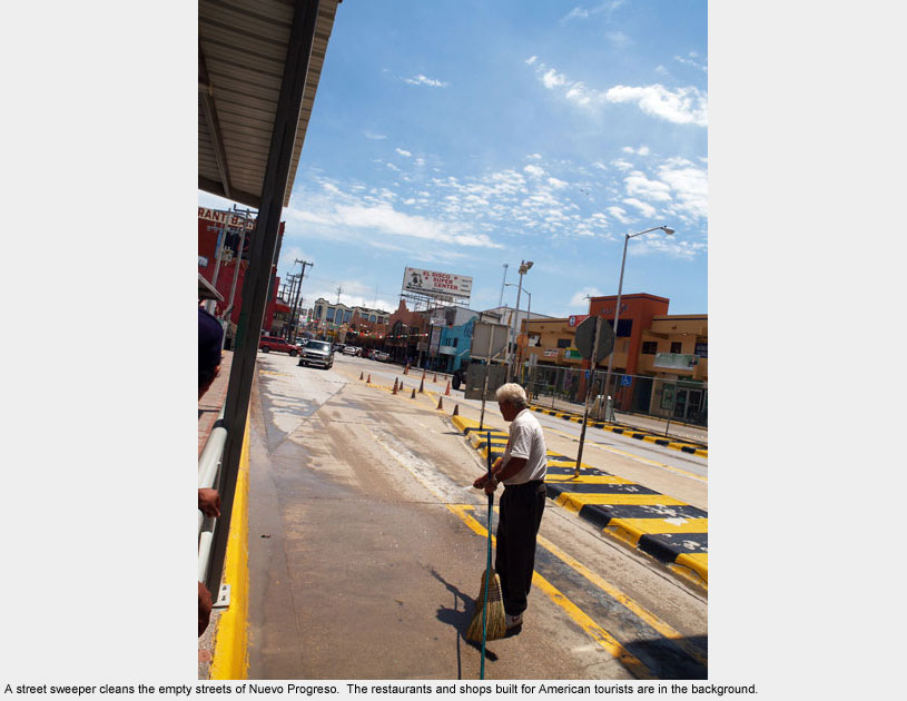
The border crossing in Progreso, Texas is rural and undeveloped on the U.S. side, while Nuevo Progreso on the Mexico side is a beautiful little town that was once a popular destination for tourists who traveled there to buy pharmaceuticals, eyeglasses, food, and gifts.
Due to fears of border violence, the streets were mostly empty when we visited.
Despite a heavy Mexican military presence including tanks and machine guns trained on the crossing, even the “Winter Texans” – people from other U.S. states who once chose to spend the winter in close proximity to Mexico and its bargains – have stopped going.
Even so, the president of the Nuevo Progreso Chamber of Commerce claims that the area continues to be peaceful.
McAllen / Reynosa
McAllen / Reynosa
This busy border crossing between the states of Texas and Tamaulipas, Mexico is the home of numerous stories of migration.
One of the stories we heard first-hand was that of Thomas Koblecky – a U.S. citizen from the Midwest who met Yirit, a Mexican national, while working at Home Depot with her.
When they decided to marry, they told the government the truth about her immigration status. As a result, Yirit was deported and Thomas had no other choice but to move to Mexico to keep the family together.
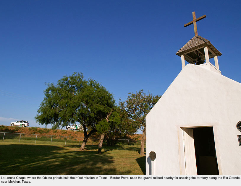
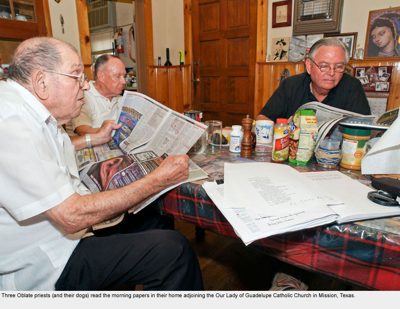
While in the vicinity of McAllen, we visited La Lomita, the first mission built by Oblate Catholic priests who ministered to native populations on the border beginning in the 1840s.
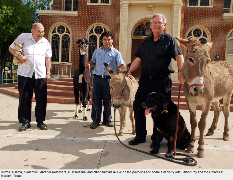
Father Roy Snipes and his co-priests – present day Oblates – live in Mission, Texas, where they work with both new and old immigrants on the border.
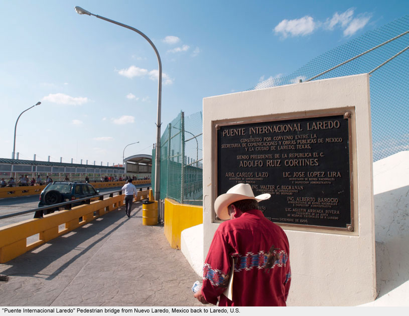
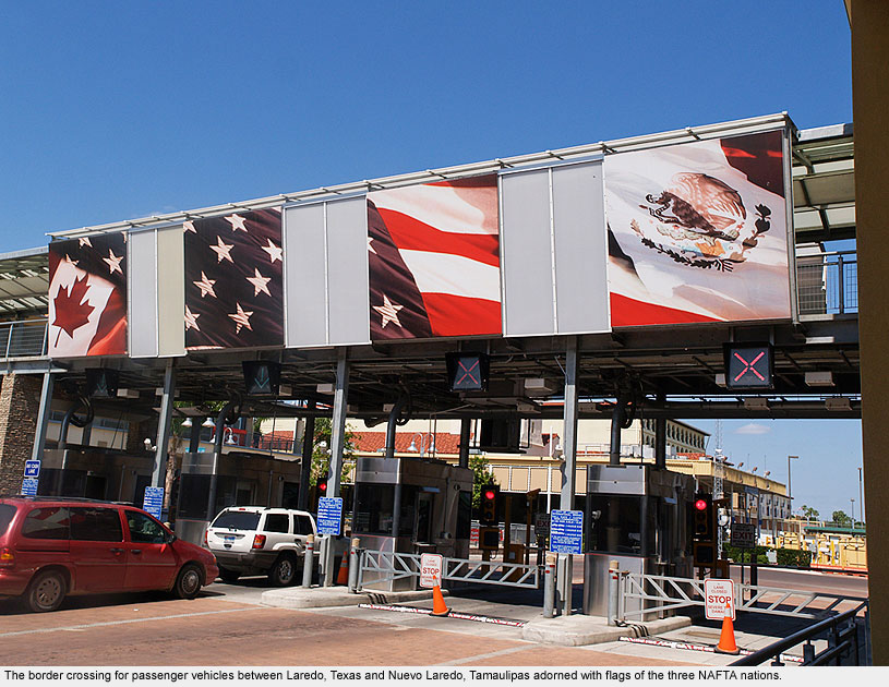
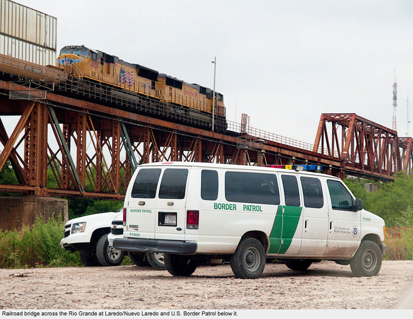
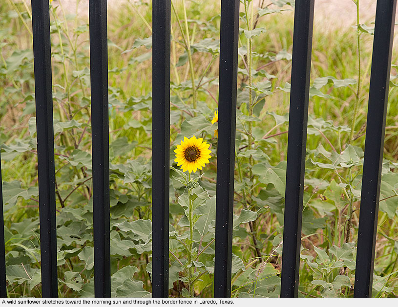
Laredo / Nuevo Laredo
Laredo / Nuevo Laredo
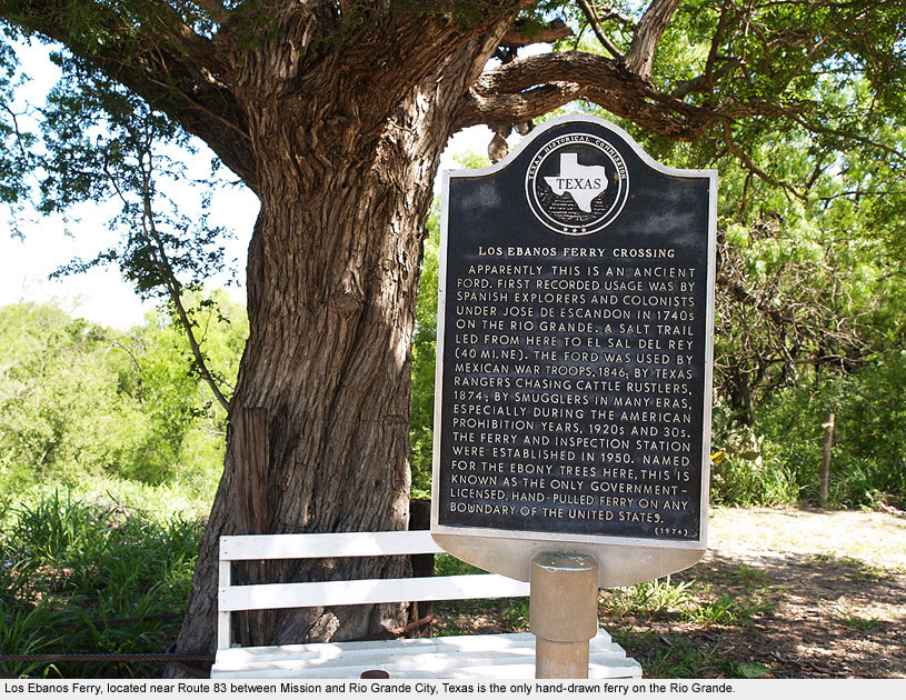
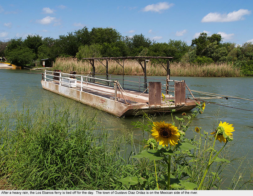
Leaving Mission, Texas and heading toward Laredo on Route 83, we passed through Los Ebanos, a small town in Texas that is host to the only hand-drawn ferry on the Rio Grande.
A legitimate border crossing sanctioned by both governments, Los Ebanos is amongst the few crossings that could be considered peaceful.
In contrast, the Laredo/Nuevo Laredo crossing is anything but tranquil. Here, amongst the chaos of thousands of cars and pedestrians squeezing through narrow chutes, everyone is required to show their papers, as police dogs prowl for drugs and immigration agents patrol with automatic weapons at the ready.
The Cadillac Bar, perhaps the most popular tourist site in Nuevo Laredo, was closed in 2010 due to the drop in clientele caused by fears of border violence.
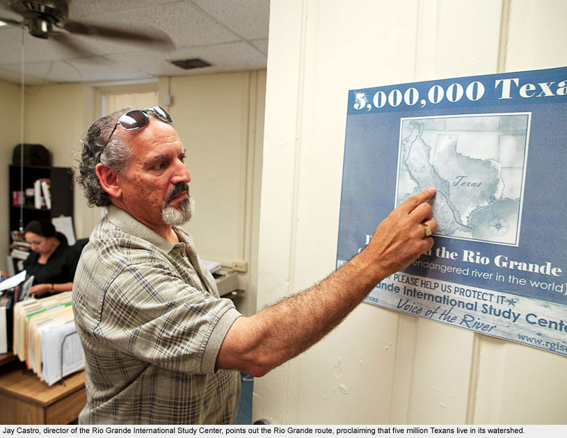
Known for their centrality to border issues, the Laredo twin cities are home to a number of border-related NGOs, including La Casa Misericordia and Rio Grande International Study Center.
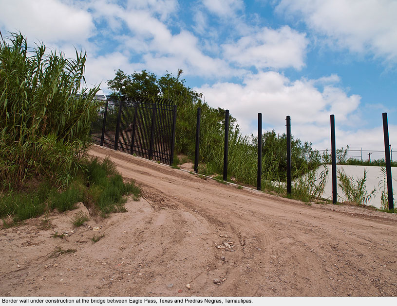
Eagle Pass / Piedras Negras
Eagle Pass / Piedras Negras
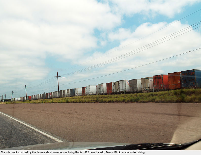
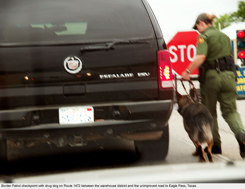
The most direct route between Laredo and Eagle Pass, Texas heads west through a cluster of warehouses and thousands of parked transfer trucks: signs of recent construction on a major thoroughfare between Mexico and the U.S. created specifically for NAFTA trade.
Though clearly marked on a map, the road deteriorates from four lanes to a dirt road with potholes big enough to swallow a small car.
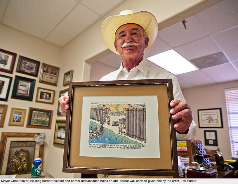
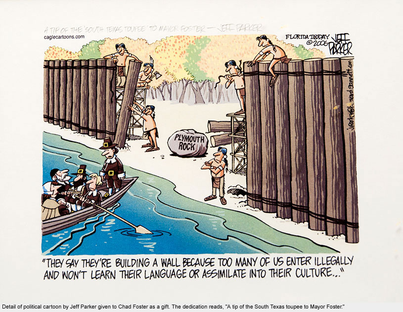
At its end we met Mayor Chad Foster, a quintessential cowboy gentleman and self-proclaimed border ambassador, fluent in Spanish. The walls of his office were lined with photographs of Mexican and American officials, with whom he’s worked for decades.
When we drove together along the border between Eagle Pass and Piedras Negras, I told him about the way some Border Patrol officers had treated me when trying to make a photograph. Angered, he counseled, “If they give you a hard time, you just tell them to kiss my grits!”
Del Rio / Ciudad Acuña
Del Rio / Ciudad Acuña
Sarah Boone, the manager of Villa Del Rio, acted as our guardian angel throughout the trip, not only recommending people and places to see along our way but also calling to check on us as we traveled.
When we finally arrived at Del Rio after much planning and anticipation, Sarah informed us that we would be the last people to stay at her B&B – ever.
Though the stately villa’s website proudly claims that it is “the closest Mexico border destination to visit Old Mexico for most Texans,” that proximity caused its closure in the end. Ciudad Acuña, like so many other Mexican border towns, is hemorrhaging economically.
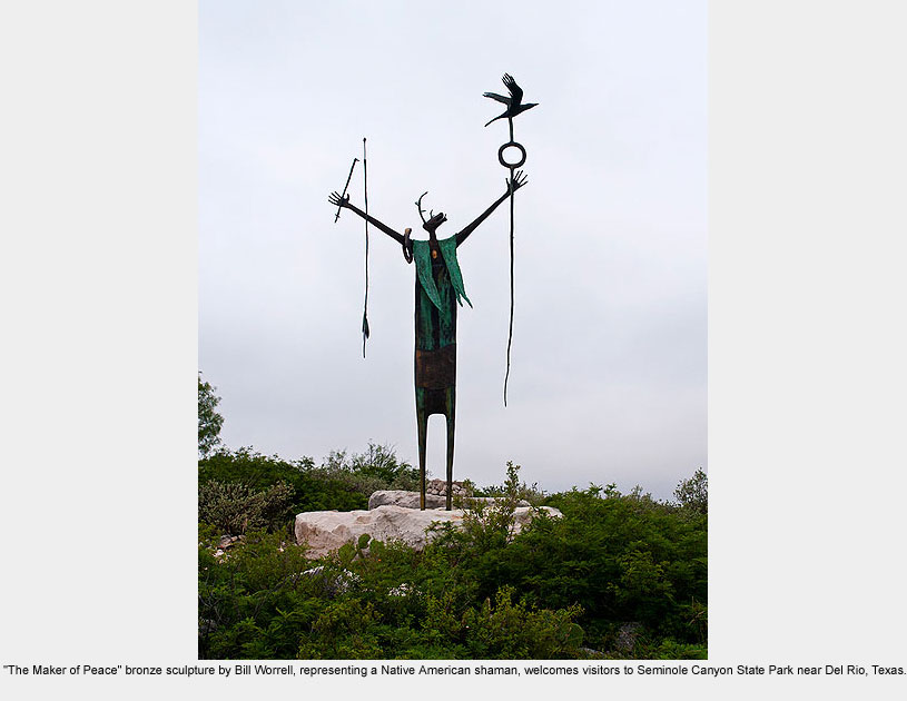
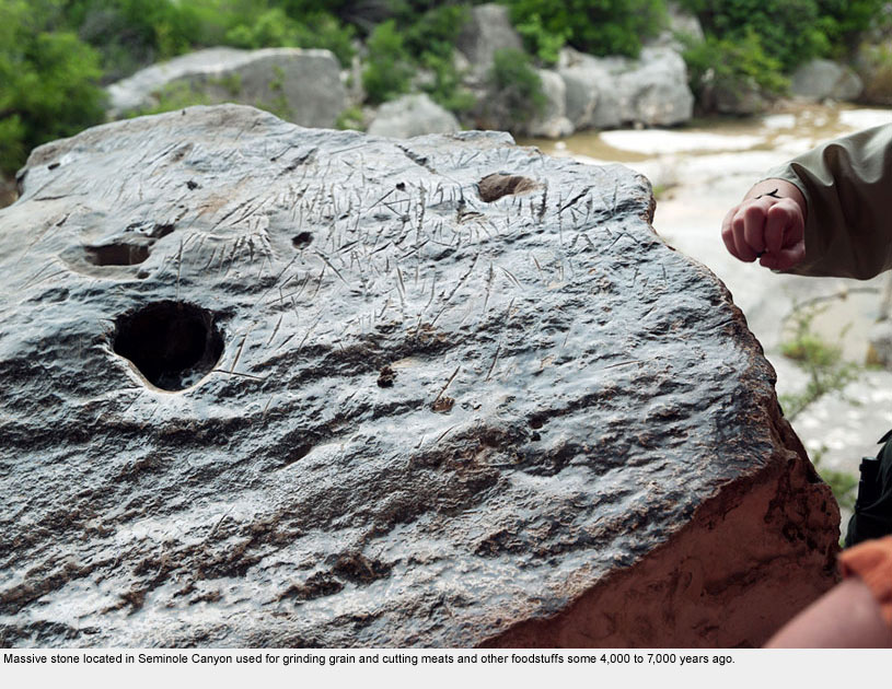
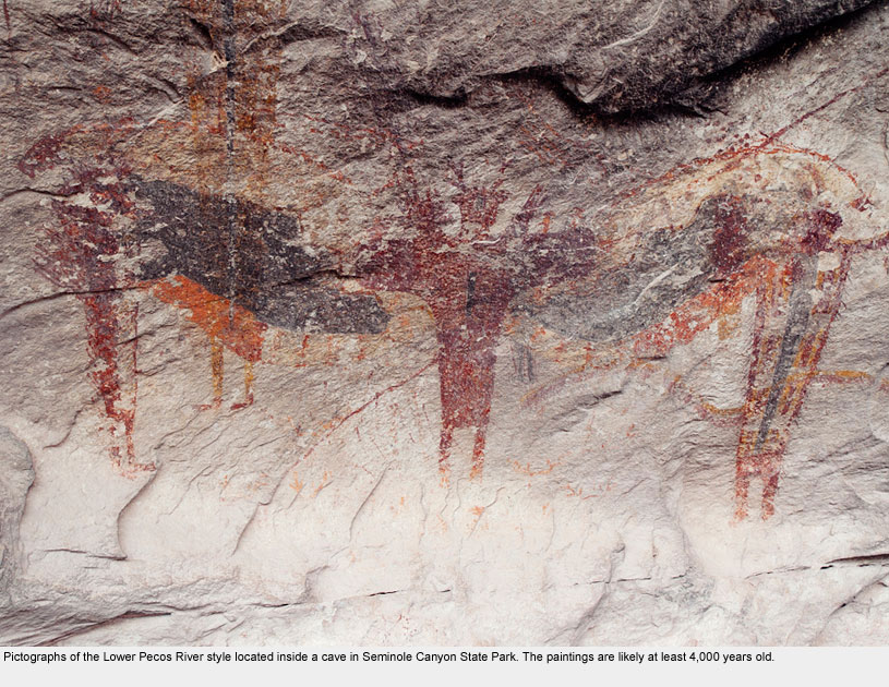
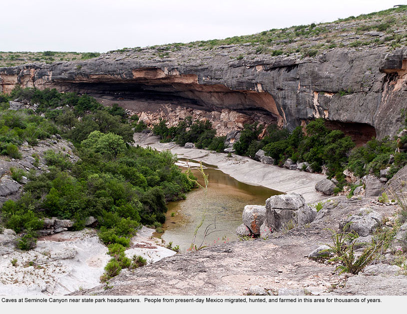
Driving away from Del Rio we visited Seminole Canyon, an ancient indigenous site inhabited as many as 14,000 years ago.
The place got its name from Black Seminoles who were stationed near Fort Clark as members of the famed “Buffalo Soldiers.”
We also passed through Marfa, one of the trendiest little towns in West Texas. It also serves as a hub for the U.S. Border Patrol.
Big Bend
Big Bend
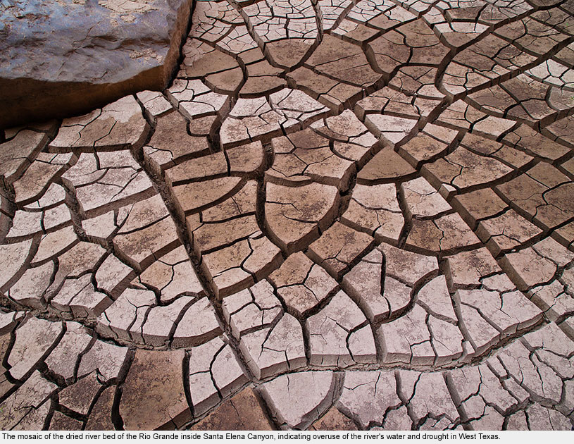
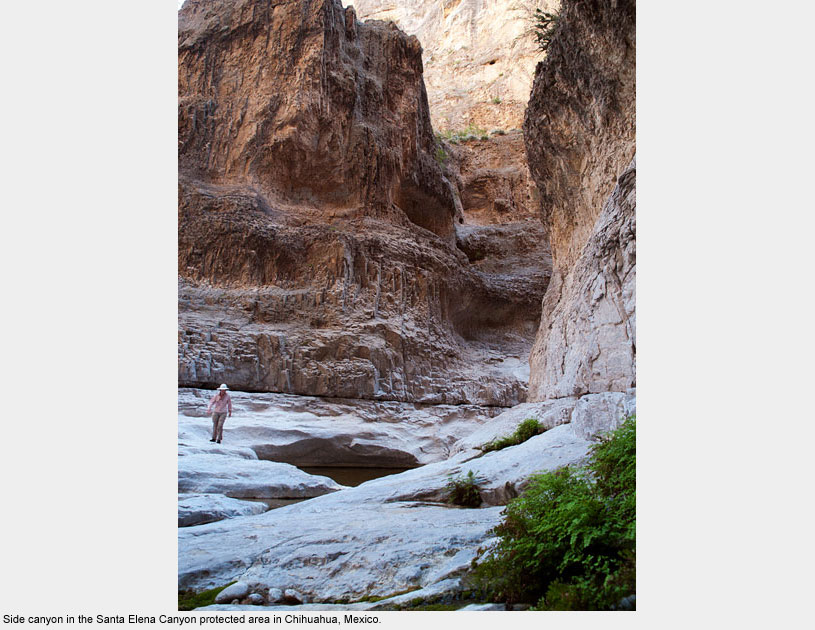
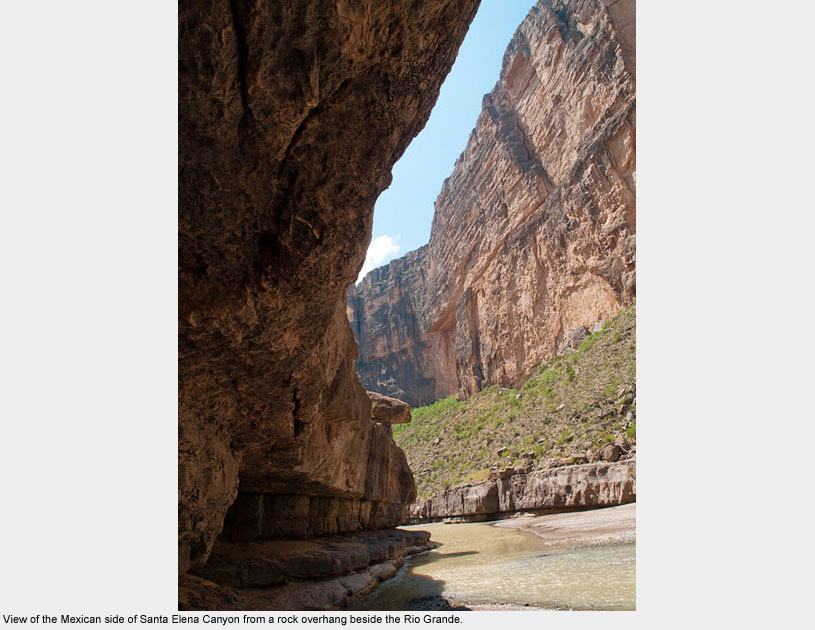
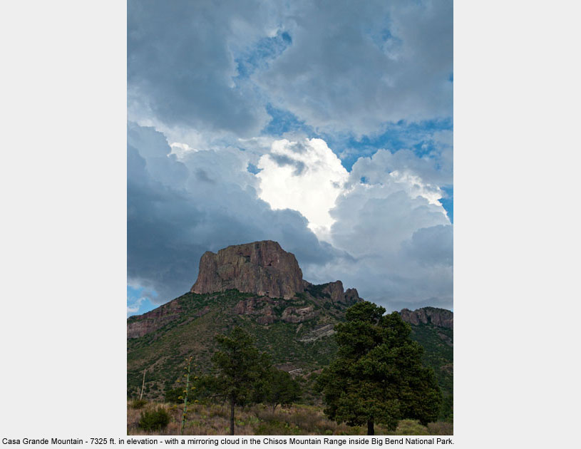
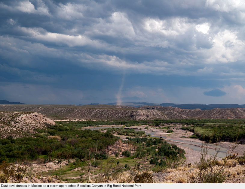
Big Bend National Park, covering over 800,000 acres, is a U.S. national treasure, but it couldn’t exist without Mexico’s help.
In 2010, President Obama and the Department of the Interior began talks with Mexico on further cooperation between the two countries, for as it turns out, this park isn’t just a national treasure after all, but a bi-national one.
On the national park’s website is the carefully-worded response to the question, “Is it safe?”:
“Throughout much of its history the border along the Rio Grande has often been fluid, allowing people of both countries to come and go as needed. However, the border is an artificial boundary imposed on the natural environment, and as such is subject to political and social pressures.”
Did we feel safe there? Absolutely.
Terlingua
Terlingua
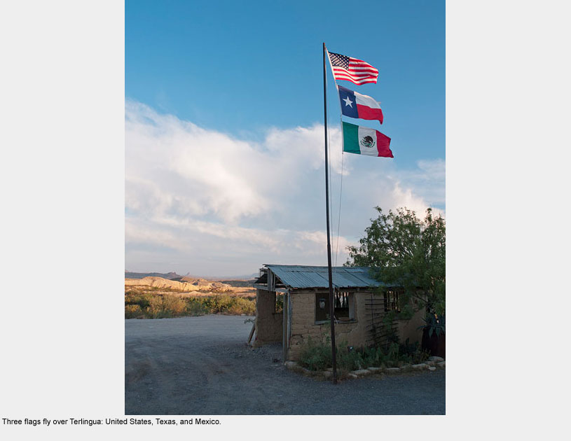
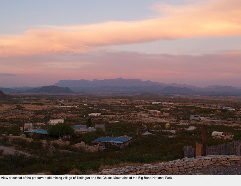
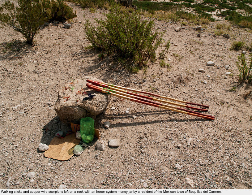
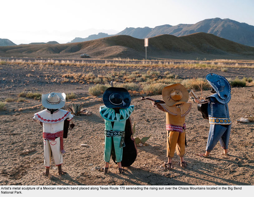
The old mining town and present-day artist community of Terlingua, Texas is located adjacent to Big Bend National Park.
River outfitters, artists, and park rangers intermingle with tourists there at a variety of restaurants and watering holes.
The townspeople of Terlingua have an ongoing symbiotic relationship with Mexico, as many of the symbols found around town reveal.
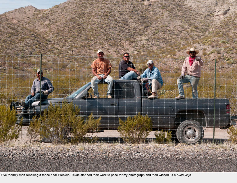
Presidio / Ojinaga
Presidio / Ojinaga
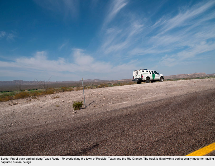
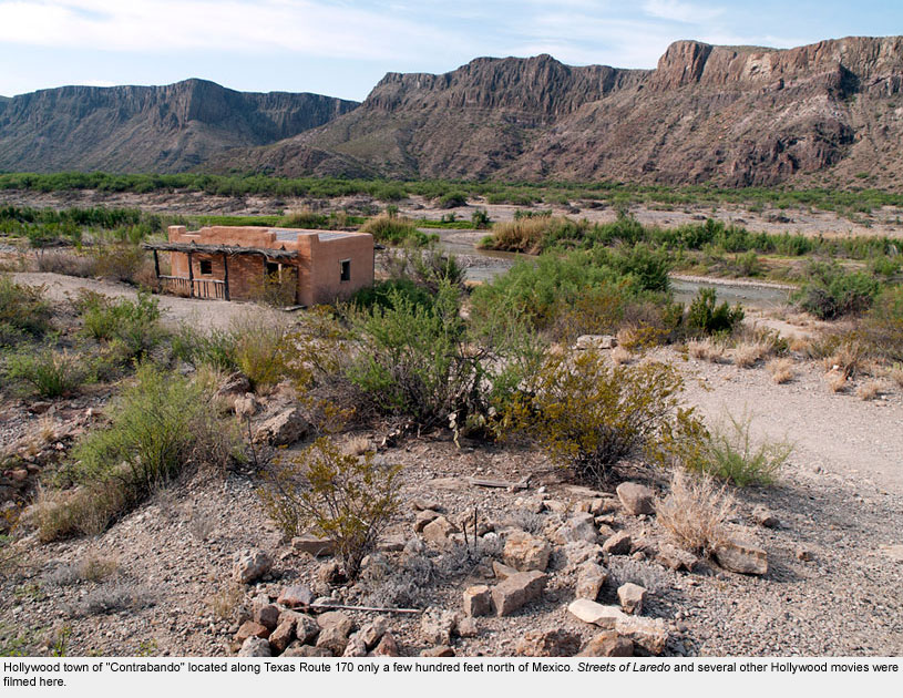
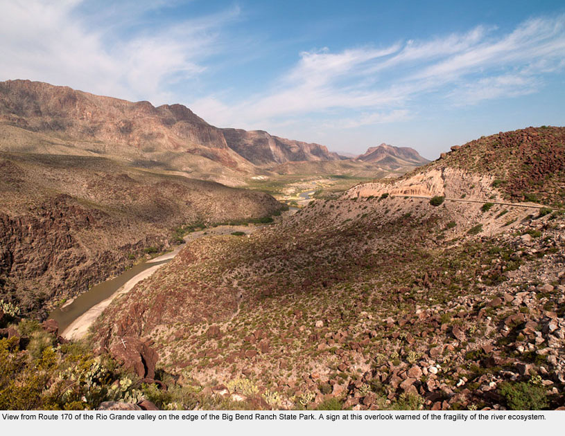
Leaving the Big Bend National Park and heading west on Route 170, one encounters more open acreage in the Big Bend Ranch State Park and the southern side of the river in Mexico.
Though dry and uninviting, the scenery is mesmerizingly beautiful. Few human beings live in the area, but Border Patrol officers are everywhere.
We were stopped at one Border Patrol roadblock near Presidio and one of the officers pointed to our Texas map and asked, “What’s that map for? … Where are you going?”
With the belief that two law-abiding citizens far from the border shouldn’t have to explain what they’re doing, why they have maps, or where they’re going, I replied, “Anywhere we please.” Hope quickly took over the conversation from there!
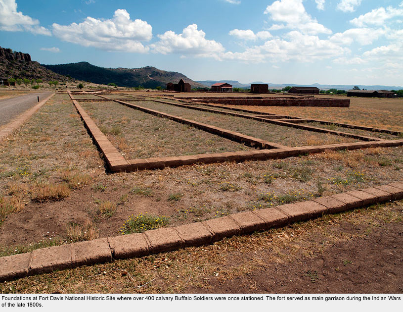
Fort Davis
Fort Davis
Though located over 80 miles from the border, Fort Davis National Historic Site was important to include here because of its centrality to our complicated national immigration story.
Consider that between 1854 and 1891, African American Buffalo Soldiers serving under white U.S. officers at Fort Davis were ordered to protect emigrating whites from attacks by Apaches, Comanches, and Kiowas, in a land that only a few years earlier had belonged to Mexico.
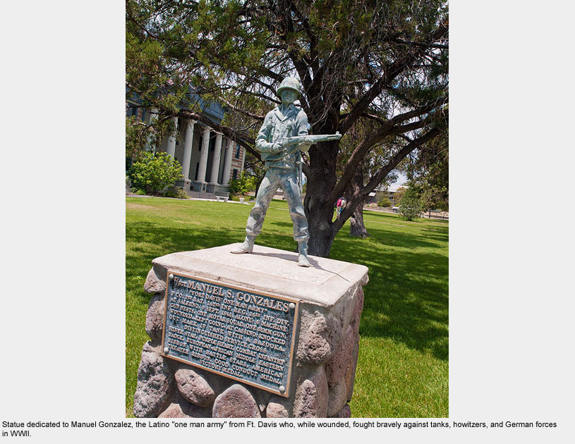
The nearby town of Fort Davis, Texas boasts a beautiful courthouse.
On its lawn, a statue dedicated to Manuel Gonzalez lauds “Fort Davis’s one man army,” for the nearly superhuman feats this lone Latino man wrought during battle in WWII.
Latinos like Gonzalez lived in West Texas centuries before whites settled there.
They and the Native American population give deep meaning to the phrase “fighting to protect our homeland.”
El Paso / Ciudad Juarez
El Paso / Ciudad Juarez
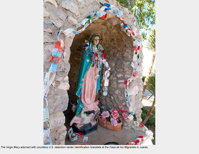
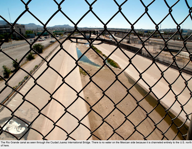
What a difference a borderline can make! El Paso, Texas is considered one of the safest cities in America, but head across the international bridge, enter Ciudad Juarez, and you’re in the murder capital of the world.
Perhaps it goes without saying that after Hope and I arrived in El Paso, parked our car in a paid lot, and walked across the bridge to meet Poncho, a friend who teaches at a university in Ciudad Juarez, we were more than a little nervous. But when he arrived at the bridge, many of our fears dissolved in a matter of seconds.
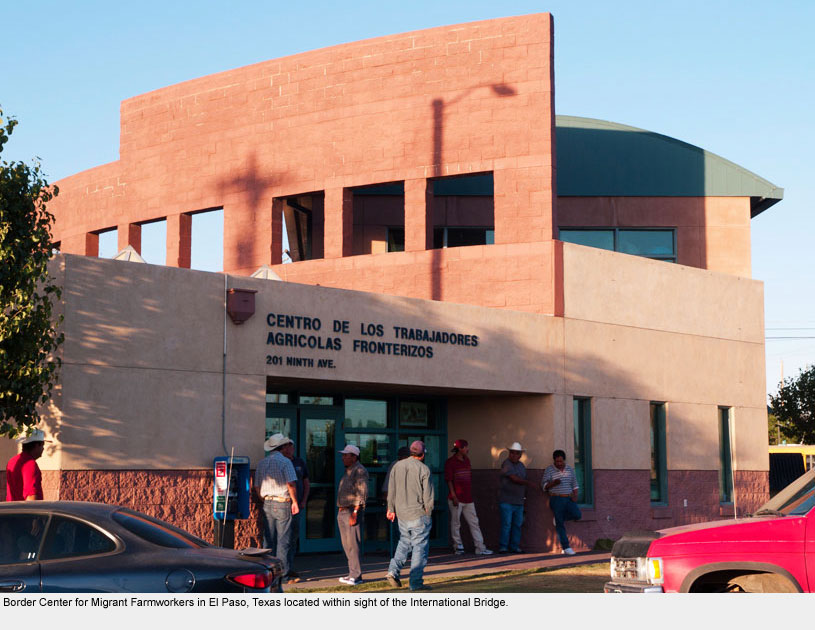
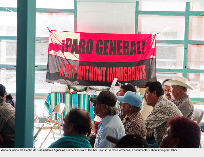
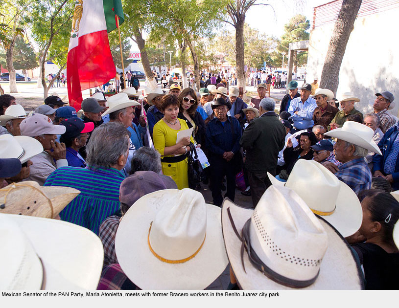
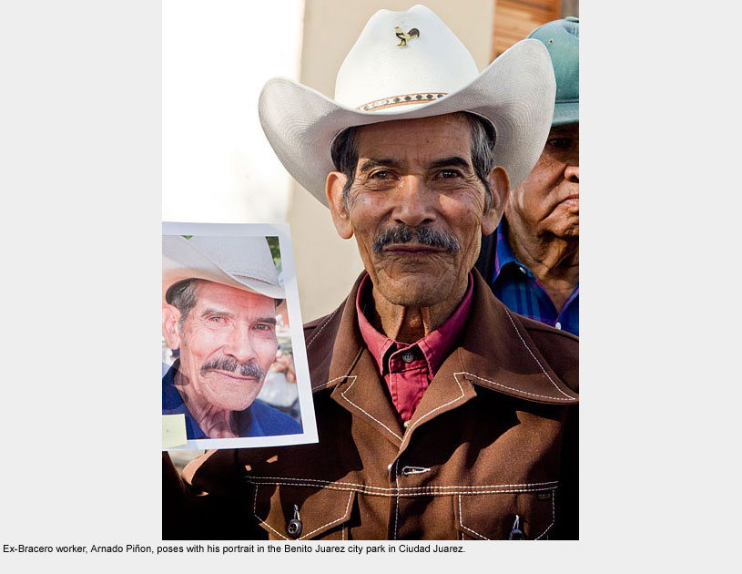
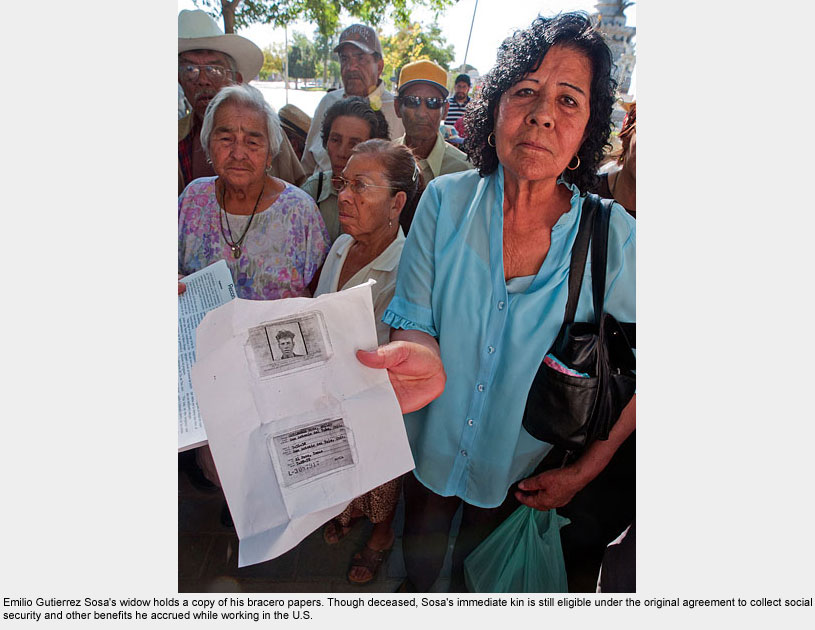
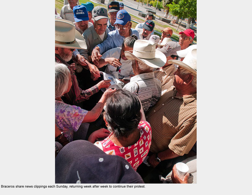
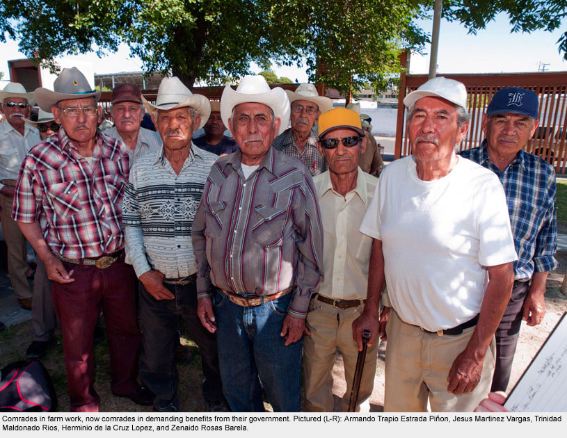
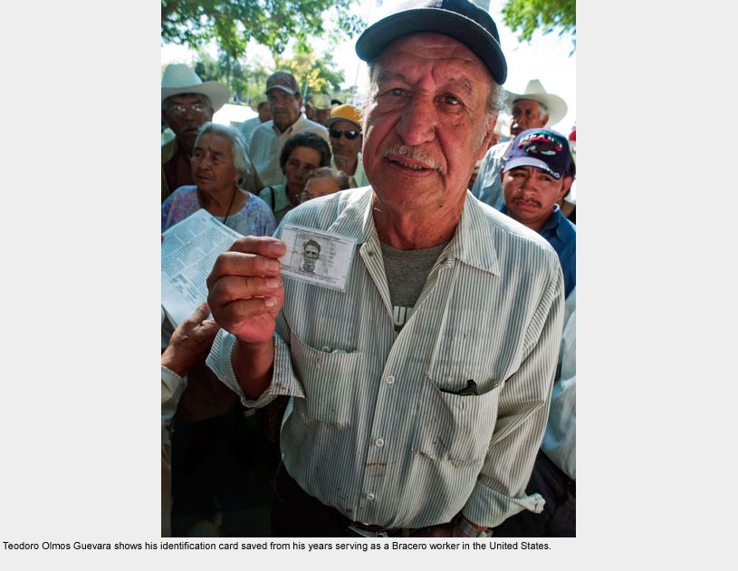
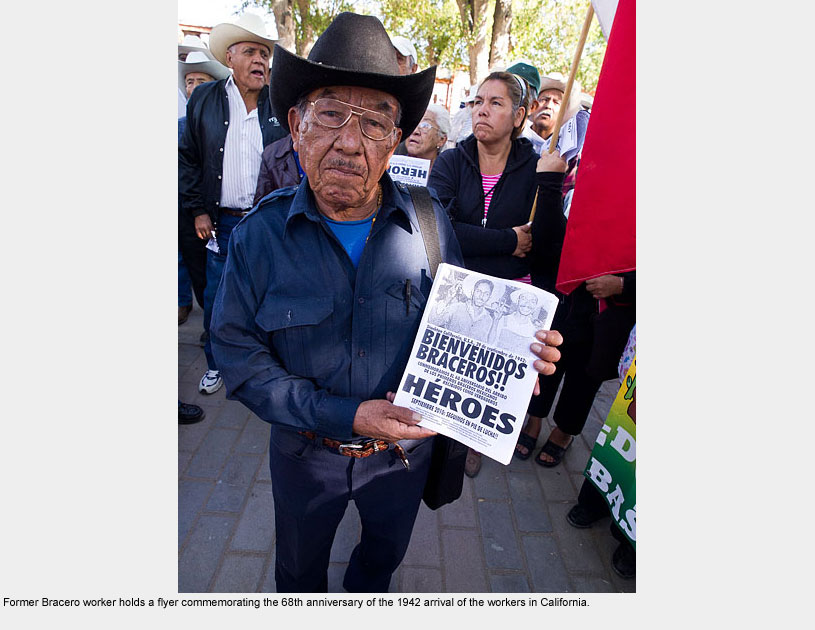
That afternoon, Poncho introduced us to a variety of organizations working with migrants and farmworkers. A few days later, after we had participated in a conference on immigration at his university, Poncho took us to meet nearly 200 ex-Bracero workers who had worked on U.S. farms between the late 1940s and the early 1960s.
Mostly octogenarians now, these were some of the bravest people we’ve ever met.
They gather in a park every Sunday in a city known for its violence and corruption and they quietly protest.
They ask for justice, for someone to remember their sacrifices, and demand the retirement benefits promised to them when they were young and working in the fields. We were perhaps the only U.S. citizens who’d ever attended their vigil.
As Poncho introduced us to this venerable group, I took a few random photographs with permission, and suddenly it seemed that everyone wanted portraits made and a long line formed.
I ended up taking dozens of portraits of people exactly as they wanted to be pictured. When we returned the next year at Poncho’s invitation and were able to distribute those photos to the participants, the Braceros applauded.
Though photographs taken by a gringo in no way replace the retirement benefits or recognition these people demand and deserve, they do say that someone has noticed.
Hopefully they serve as a token of our thanks on behalf of all Americans, to whom the Braceros gave their best years, and further their call for justice.
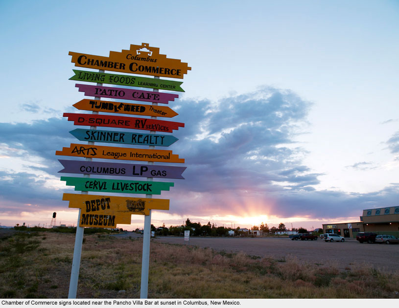
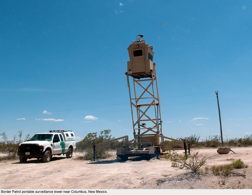
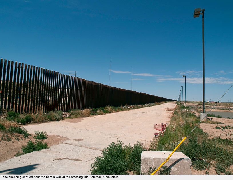
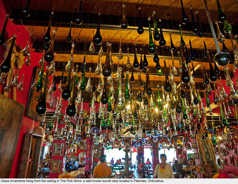
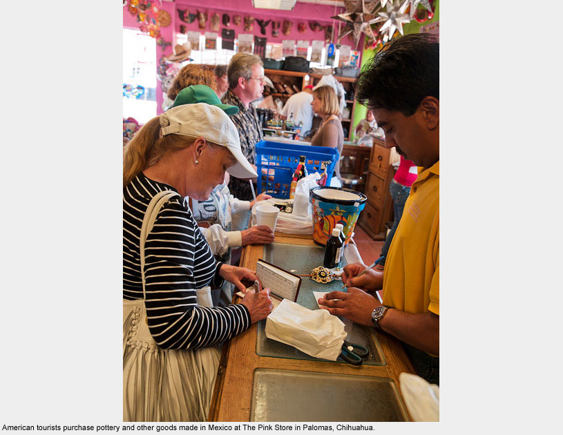
Columbus / Palomas
Columbus / Palomas
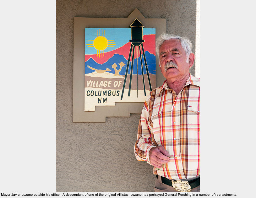
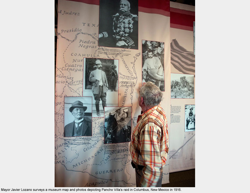
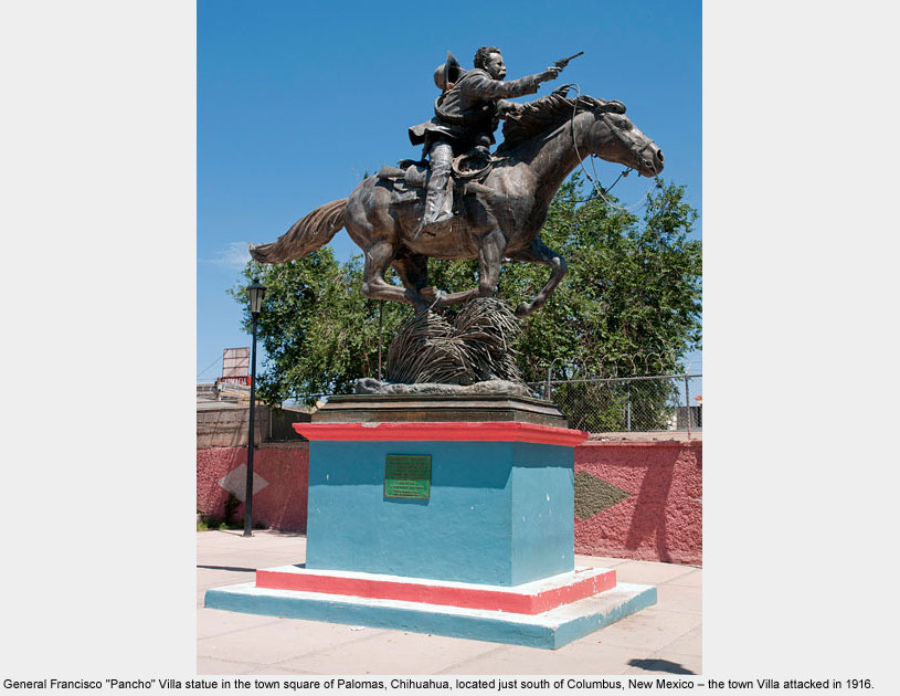
Columbus is best known as the site of Mexican revolutionary Pancho Villa’s attack on the U.S. garrison in 1916.
Many believe this attack, resulting in the deaths of at least 18 Americans and nearly a hundred Mexican soldiers, was a reaction to U.S. support of Mexican President Carranza, the dictator whom Mexican rebels were fighting.
A museum on the site of the original Camp Furlong documents the history of General Villa’s raid and General “Blackjack” Pershing’s two-year pursuit of Villa that followed.
Local businesses on both sides of the border hope that tourists continue to seek further details on this history of Villa’s raid and to buy souvenirs while they’re at it, but border violence, including the murder of the mayor of Palomas in 2009, has kept them at bay.
The Pink Store, one of the most tourist-friendly sites in all Chihuahua, still draws a few tour groups, but proprietor, Ivonne Romero, told us that by 4:00 in the afternoon, the store and restaurant are empty. No one wants to be there after sundown.
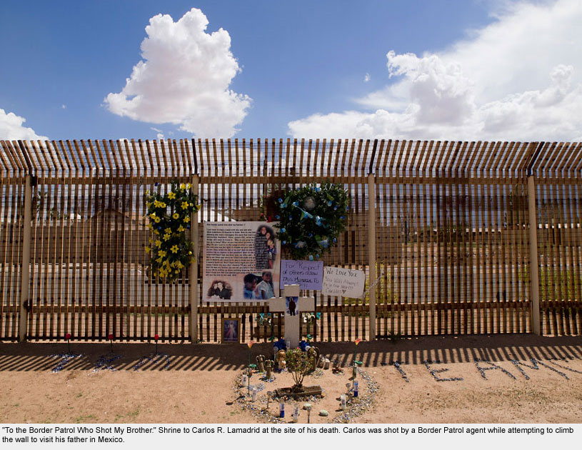
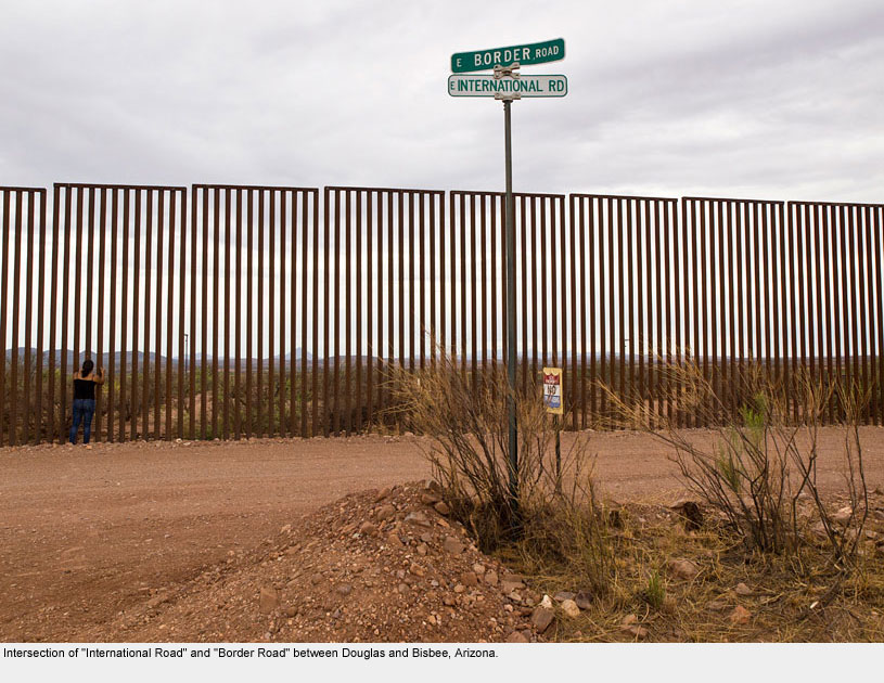
Douglas / Agua Prieta
Douglas / Agua Prieta

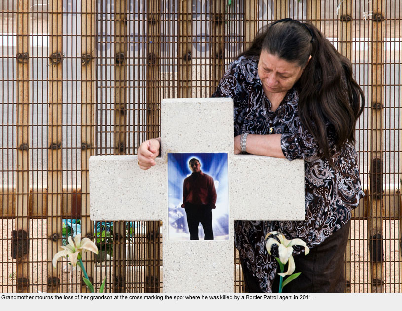
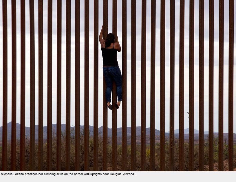
I traveled to Douglas with Michelle Lozano, one of the DukeEngage on the Border students I worked with in 2011.
We heard that there had been a shooting at the border and that the family of the victim had built a shrine at the wall.
After driving along miles of drab fence, we came across bouquets of artificial flowers, a cross, and posters with messages written in memory of Carlos R. Lamadrid. One was entitled: “To the Border Patrol Who Shot My Brother.”
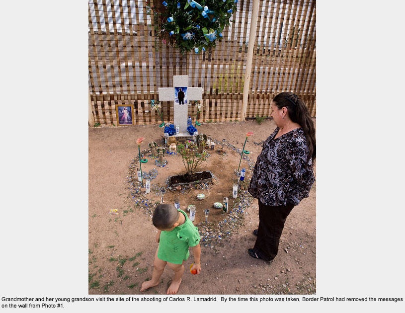
We continued several more miles to see more of the wall, and upon returning, we noticed a truck parked at the shrine. To our surprise, it belonged to the boy’s grandmother.
She and several of her grandchildren had gone there to pray and acknowledge her grandson’s death. She told us that in the thirty minutes we had been gone, the Border Patrol had come to remove the posters I’d seen and photographed.
She gave me permission to take photographs of her and to share this story.
Upon hearing a story of a border patrol shooting, one may assume that the young man was Mexican and had run into some trouble crossing the border into the U.S. The grandmother told me otherwise.
She said her grandson was a U.S. citizen whose father lived in Agua Prieta. He died trying to cross into Mexico to visit his father.
With his back to the officer, he didn’t heed commands to stop climbing. The officer shot. Carlos fell backwards and died, unarmed, on U.S. soil.
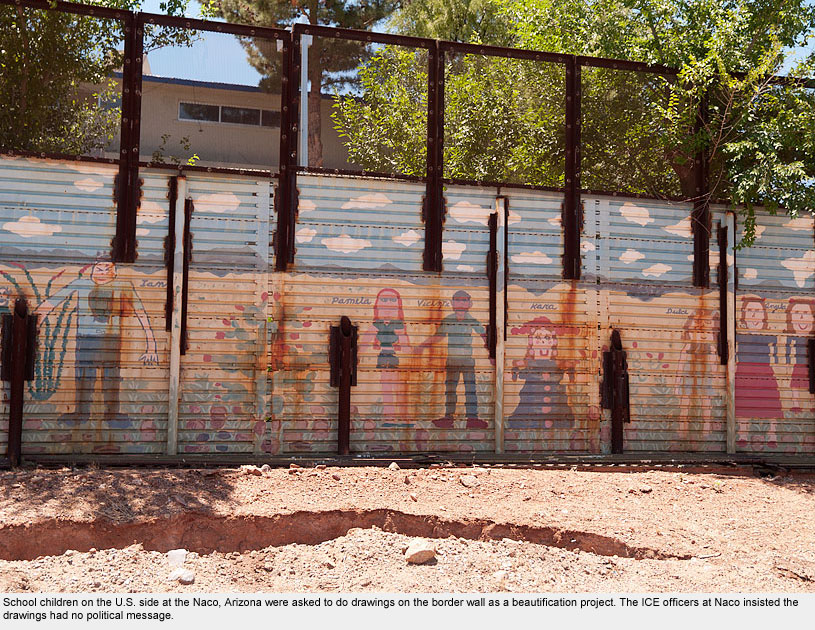
Naco / Naco
Naco / Naco
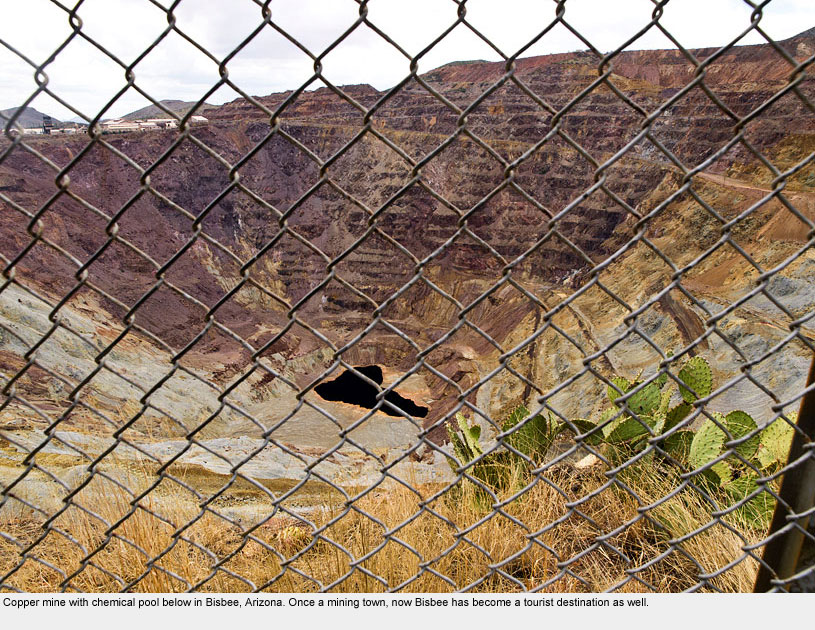
After staying in the copper-mining-turned-tourist town of Bisbee, Arizona for a night, we decided to take the twelve-mile jaunt to the border at Naco and to cross into Mexico just to see what was on the other side.
Crossing the border without so much as a wave from the guards, we realized quickly that Naco, Chihuahua had no tourist trade, and very little caught our attention there. We stayed for all of ten minutes, turned around, and headed back.
Our attempt to enter the U.S., however, was not so quick. The ICE officers stationed at this sleepy site began searching through our vehicle, took all of our papers into their office, and held us for nearly an hour, asking such questions as why Hope’s passport had been stamped in El Salvador.
A Mexican man watched from the side of the station and said aloud, “I’ve seen this on TV, but I’ve never seen it in person.” We felt like criminals.
Of course the officers found nothing of interest in the end, but after that incident Hope realized her notebook filled with details on all the places we’d visited was missing.
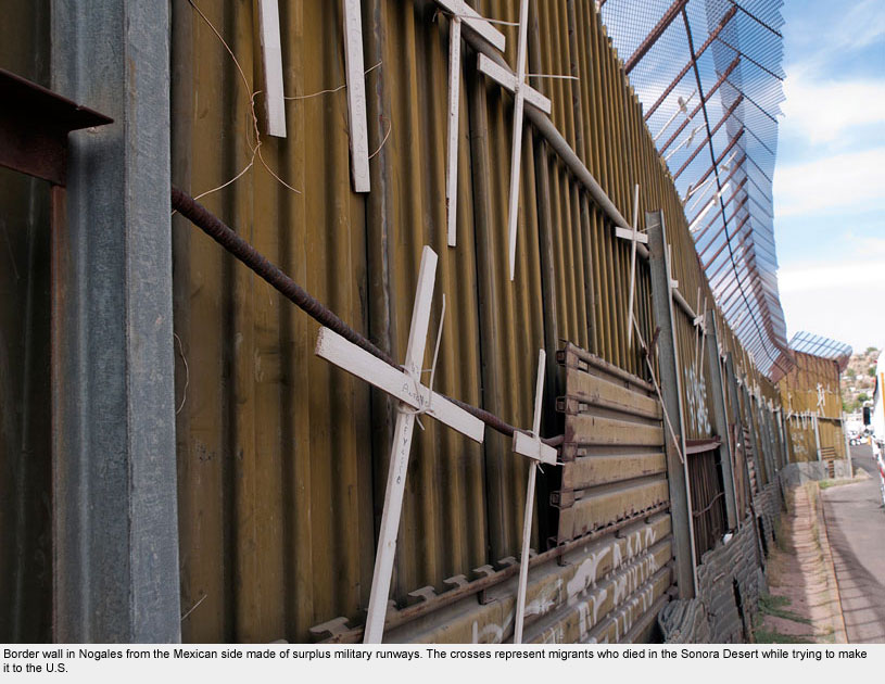
Nogales / Nogales
Nogales / Nogales
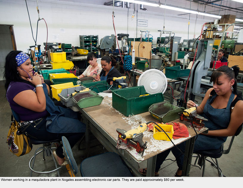
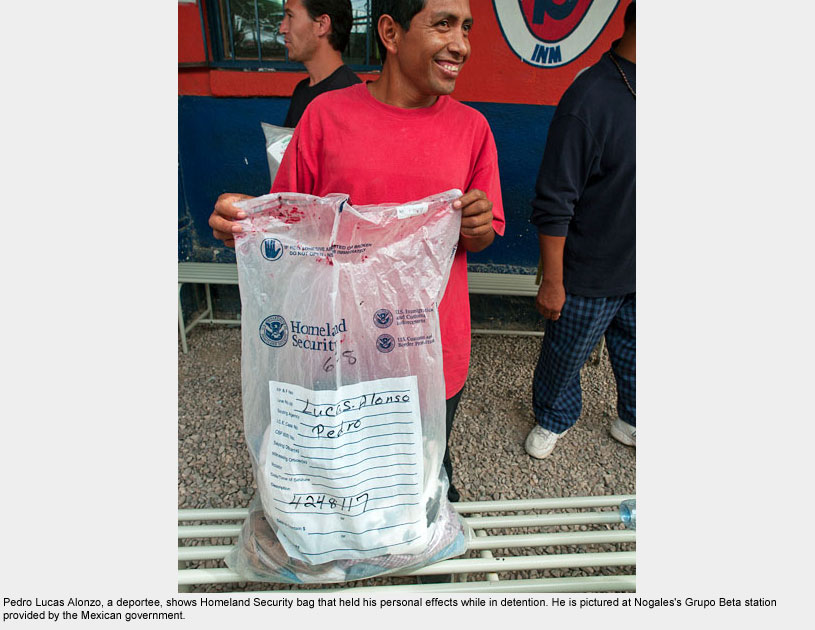
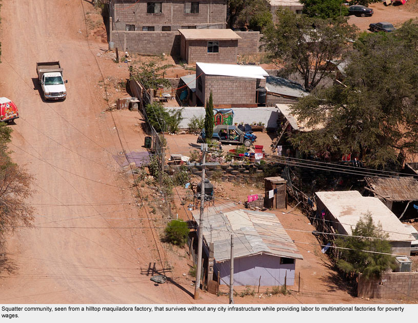
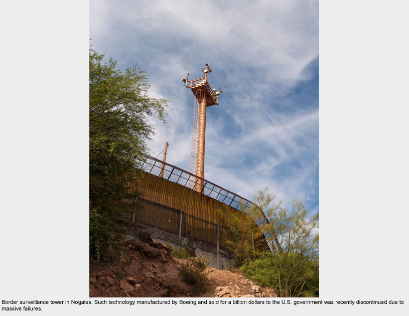
Nogales, Sonora is the main city on the map here, while Nogales, Arizona is a sleepy hamlet by comparison. But it turns out that both cities were small farming towns before the onslaught of the maquiladora economy that has taken Mexico by storm since the 1980s.
Now approximately 100 manufacturing plants have located there due to the North American Free Trade Agreement (NAFTA).
Nogales’s economy has shifted to low-wage manufacturing, creating an influx of tens of thousands of small farm refugees who are forced to live in neighborhoods without any infrastructure.
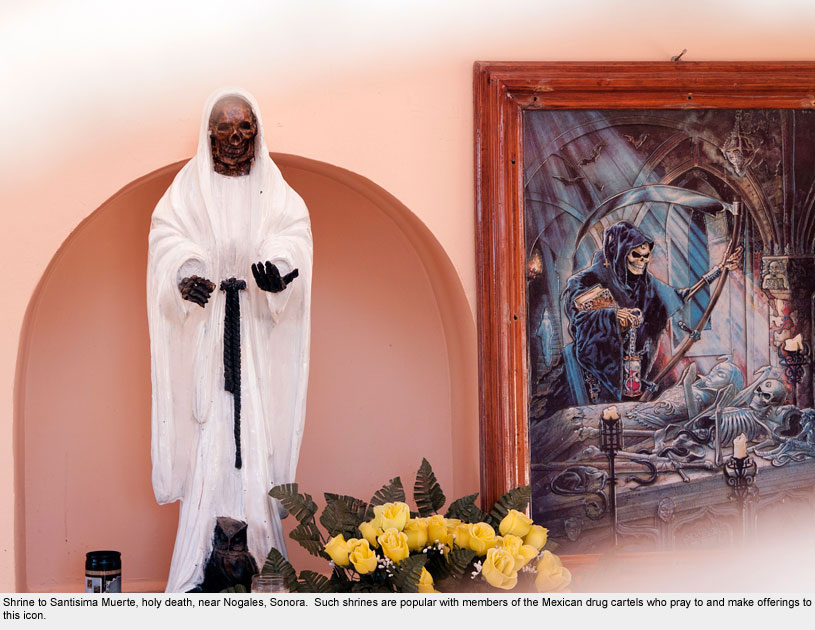
Often out of desperation, those who’ve already moved once to work at the border, try to cross into the U.S. to earn money to survive. Human and drug trafficking have increased here as well, especially as drug lords exploit poor human “mules” (as the drug lords call them) to haul goods into the U.S.
Tucson
Tucson
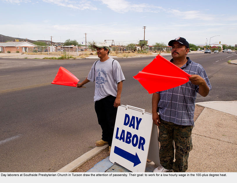
Arizona is ground zero of the immigration crisis, and Tucson has become a main staging ground for humanitarian action for migrants. This is why I organized a summer service project for students in Tucson and Nogales starting in 2007, calling it “DukeEngage on the Border.”
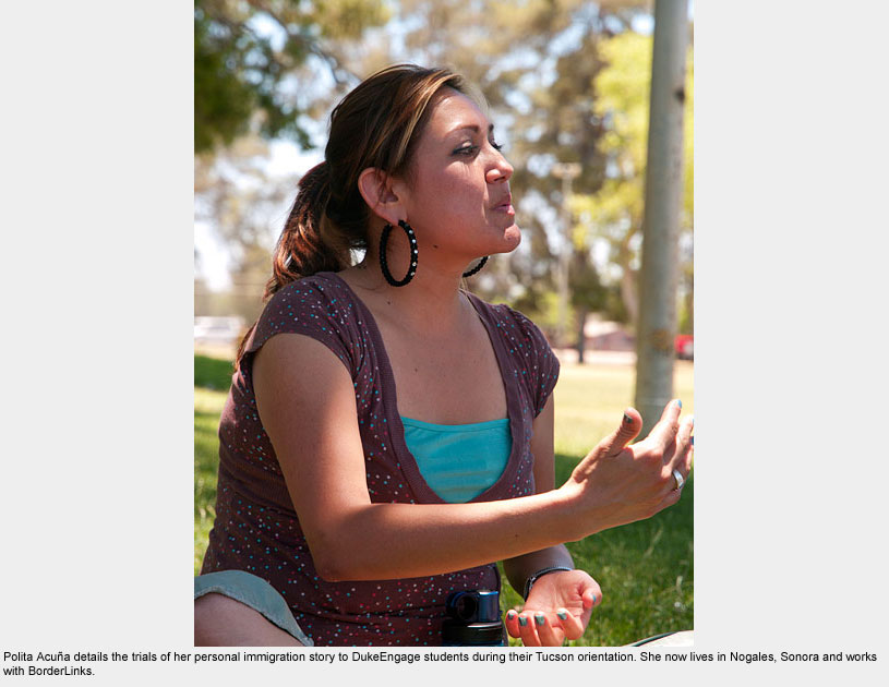
2010 made the fourth year of the project, and Hope and I scheduled our Border Odyssey to intersect with the arrival of eight students at BorderLinks, a humanitarian organization dedicated to education and advocacy related to immigration, and where the students would live for eight weeks of the summer.
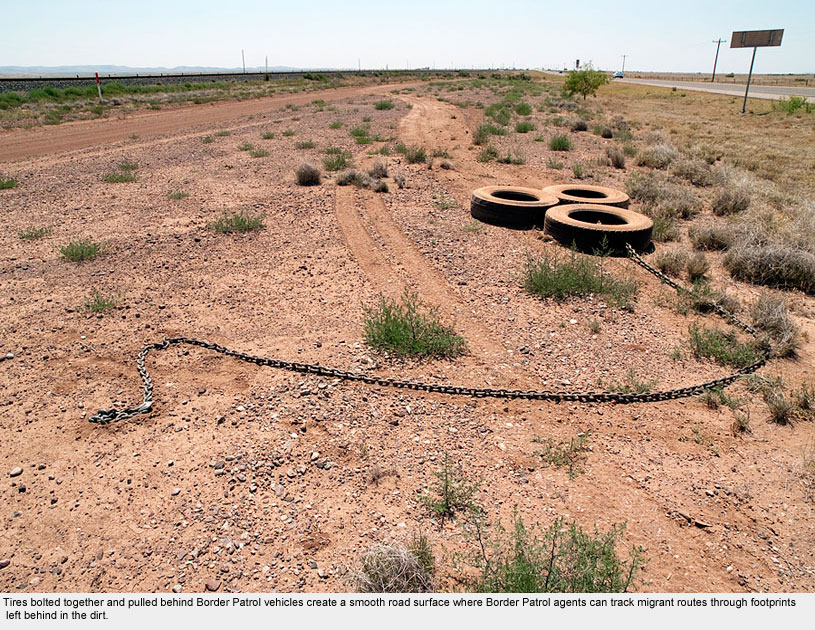
In recent years ICE and the Border Patrol have used walls and surveillance to funnel migrants toward the Sonoran Desert near Tucson, thereby making the trek as arduous as possible.
No one is sure whether this has worked as a deterrent, but it is certainly killing people. As part of our orientation, we participated in a walk to remember those who have died, walking from the border back toward Tucson.
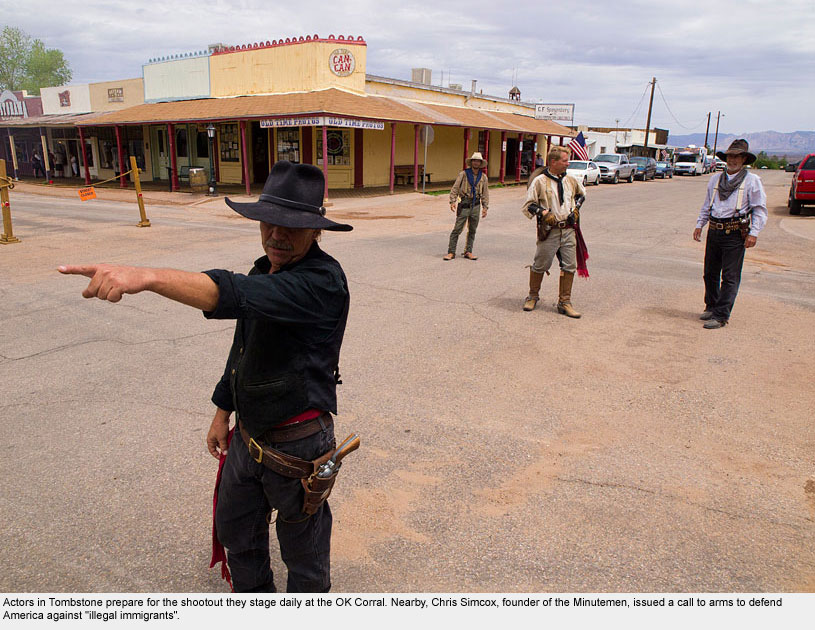
Although Hope headed back to North Carolina for work, I stayed with Borderlinks to help with the students’ orientation. We introduced students to the Tucson area, including a visit to the nearby tourist town of Tombstone, Arizona, where make-believe cowboys shoot it out daily.
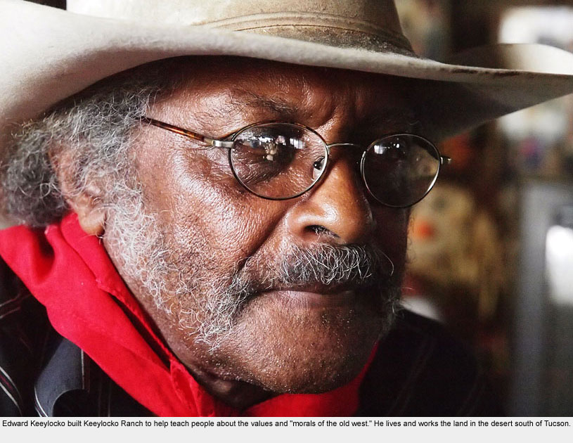
Tombstone was also the birthplace of the Minutemen: ersatz cowboys of sorts who have appointed themselves as private border patrollers. We also met Mr. Keeylocko, a man who has played numerous African American cowboys in the movies and who now runs a ranch in a different part of the desert.
As the students began their internships with humanitarian groups, I continued my trek toward the western end of the border alone.
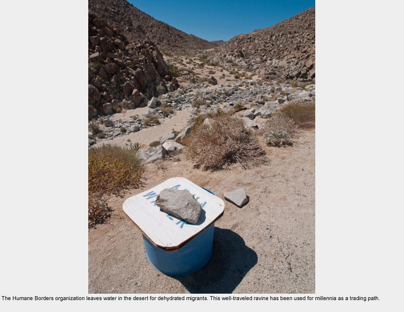
Sasabe / Sásabe
Sasabe / Sásabe
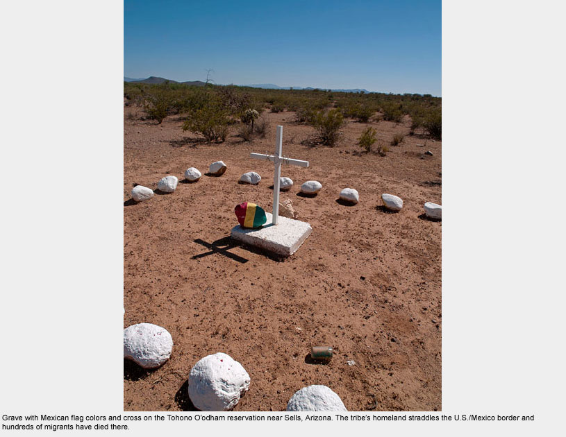
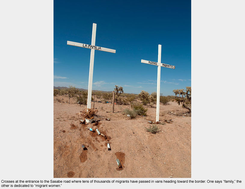
Sasabe, Sonora, located in the middle of the Sonoran Desert, is the sending point for thousands of migrants who cross the deadly sands leading into Tucson and beyond.
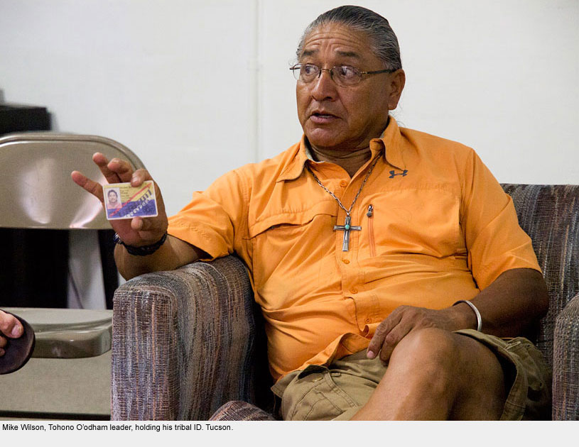
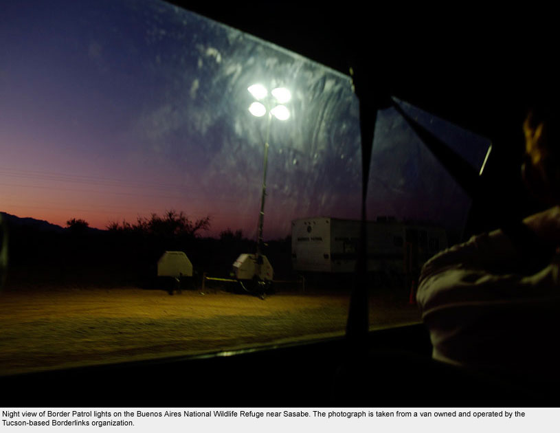
Nearby are two well-known sites owned by the U.S. government, both of which have become heavily trafficked migrant routes: Buenos Aires National Wildlife Refuge and the Tohono O’ohdam Indian Reservation.
Migrants and their coyotes use these areas mostly because they are remote and sparsely populated, but the rough open country there also makes the routes the most dangerous.
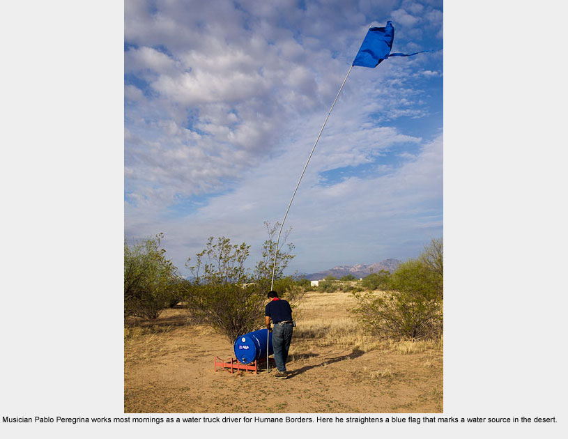
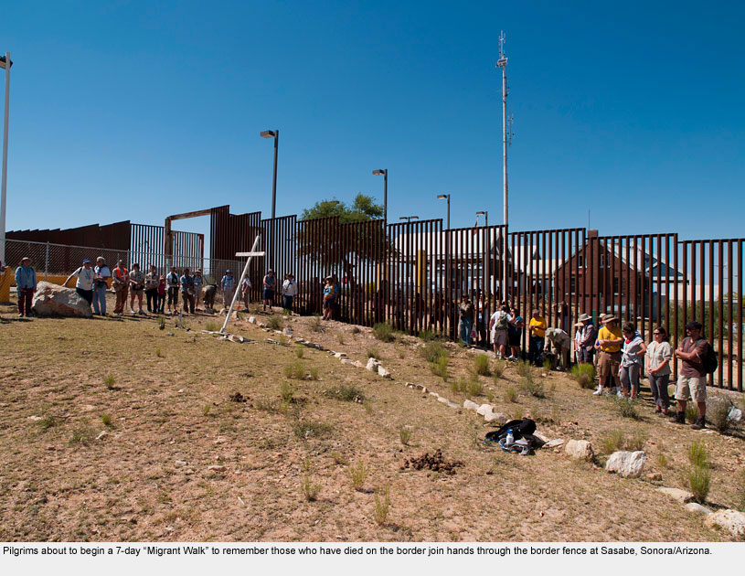
Despite the efforts of organizations such as No More Deaths, Humane Borders, and The Samaritans (all Tucson-based) that regularly tend water stations in the desert in order to prevent senseless deaths, hundreds of migrants die in the Sonoran Desert every year.
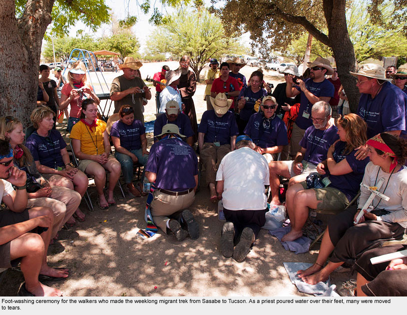
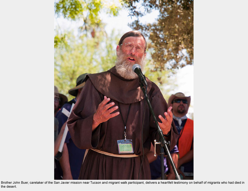
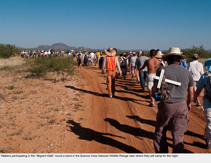
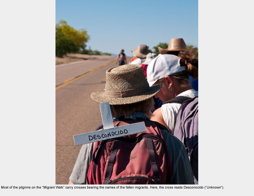
Each May, the Human Rights Coalition in Tucson leads a “Migrant Walk” dedicated to the memory of more than 3000 children, women, and men who have died trying to make it into the U.S. in the last ten years.
The official causes of death are dehydration, heat stroke and other physical traumas, but the true causes in so many cases are the love of family members and a willingness to make sacrifices for them.
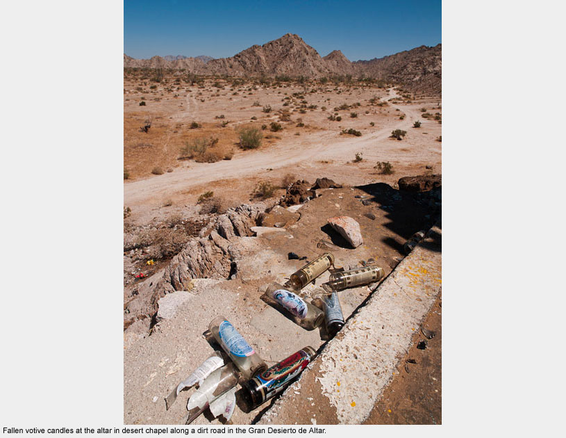
Altar
Altar
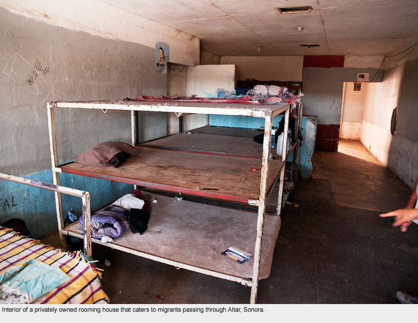
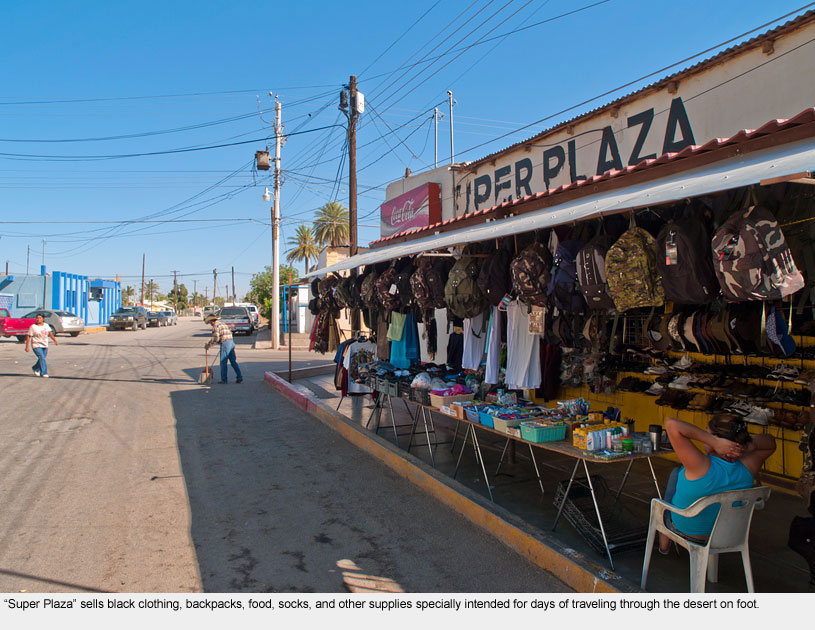
Located in the middle of the Sonoran Desert where almost no rain falls and the summertime temperatures reach 120 degrees, the small town of Altar is the main stop for migrants heading into Arizona.
At the height of the immigration flow, thousands of migrants passed through the town, many stopping to buy backpacks, food, water, and warm clothes for the desert nights.
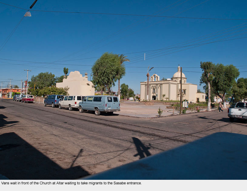
Most migrants who go there stay for a few days waiting to meet a coyote in front of the church in the center of town. Dozens of businesses cater to the migrants in the meantime.
The Catholic Church in Altar provides free services and meals for those passing through Altar.
The priest and congregants walk the road leading to Sasabe once a year, some 8 miles through the desert sun, to remember those who have died in the crossing.
Within sight of the crosses they erected to mark the end of their pilgrimage, a cartel that no one asks about has erected a guardhouse and gate from which they charge each migrant to cross their land.
Phoenix
Phoenix
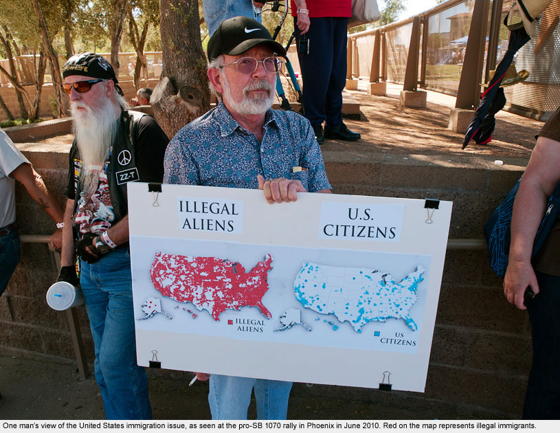
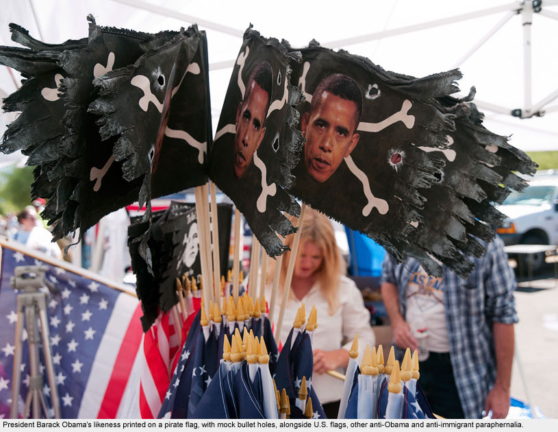
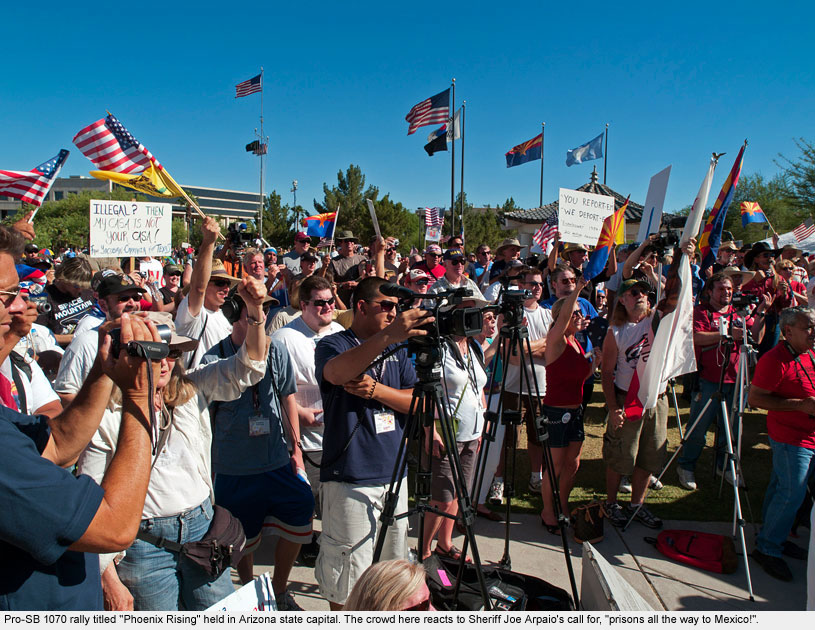
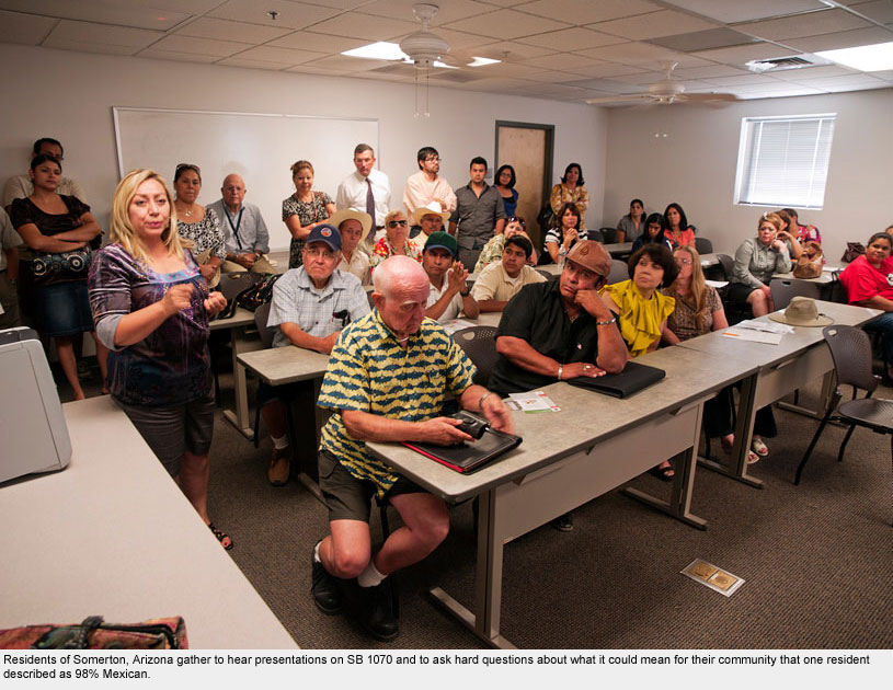
In 2010, a huge showdown on the immigration issue emerged in Phoenix and all of Arizona with the passage of the controversial SB 1070 law giving local law enforcement officers power to enforce national immigration law.
Boycotts in Arizona began immediately, and rallies against the law sprang up across the nation.
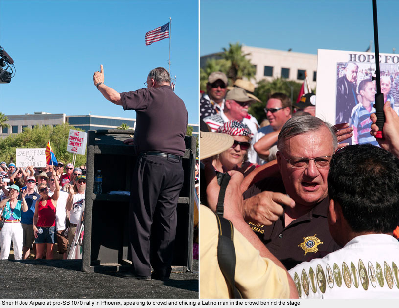
On June 5, as part of the DukeEngage on the Border project, I traveled with three students to a pro-SB 1070 rally called “Phoenix Rising” in the Arizona capital where we heard speakers Sheriff Joe Arpaio, the former congressman Tom Tancredo, and State Representative Russell Pearce deliver their rallying cries in the 107-degree heat.
Two thousand or so gathered to cheer them on. The blistering language from the stage; placards attacking Obama, Mexicans, and any “illegal immigrant”;
the biker gangs wearing “White Boy” insignias; racist groups selling flags, t-shirts and other paraphernalia, along with a number of men and women “packing heat” – all gave the rally a less-than-subtle undercurrent of hatred and fear.
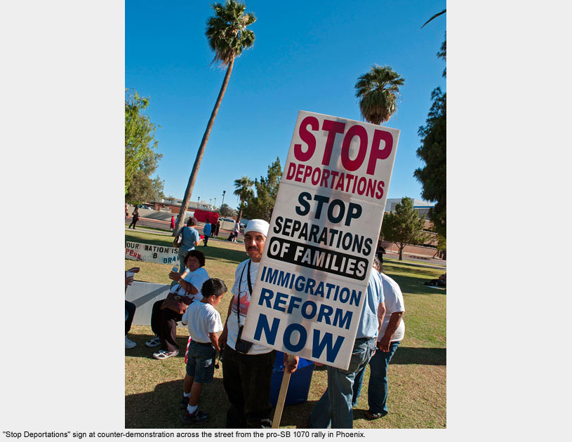
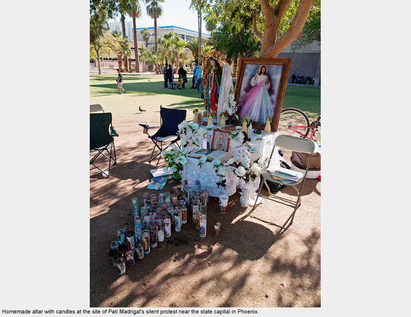
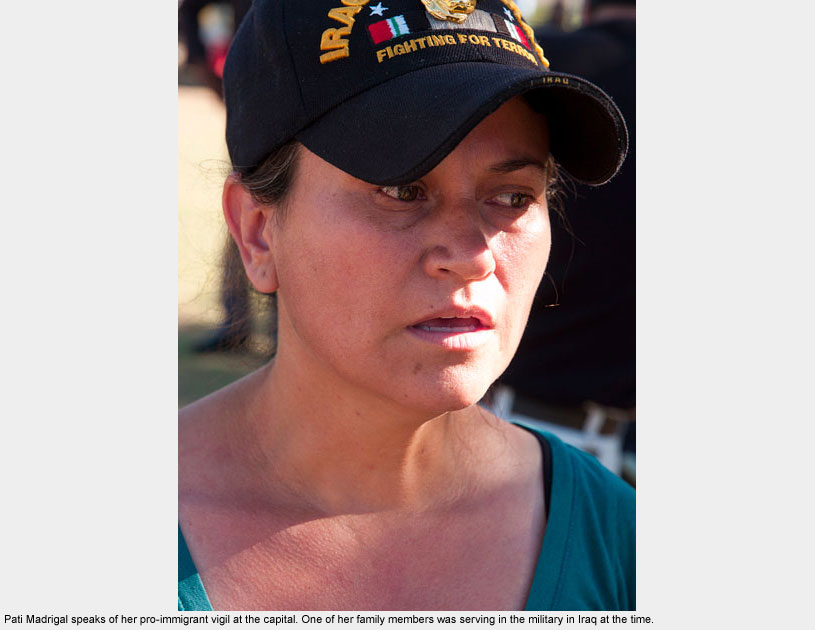
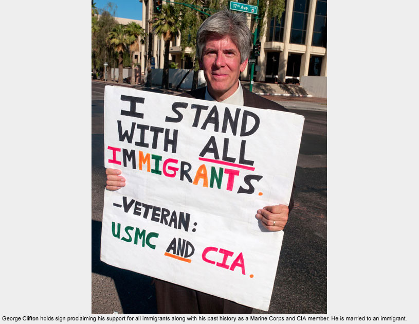
We walked across the street to find a quiet counter-protest. About forty people sang in the shade of a tree where hunger striker Pati Madrigal prayed and lit candles.
Nearby the United Farmworkers held their sign in solidarity. George Clifton, retired Marine and former CIA employee, stood on the street corner with a pro-immigrant sign, waving and smiling to passing motorists.
He summed up his protest this way: “I feel cowardly if I don’t do anything. After all, I lucked out… my mom had me here.”
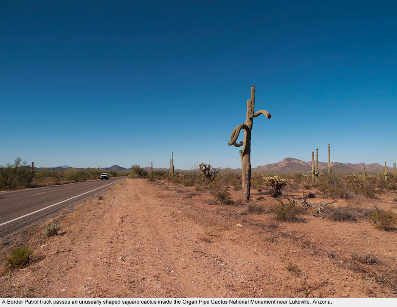
Lukeville / Sonoyta
Lukeville / Sonoyta
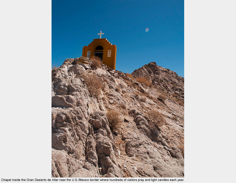
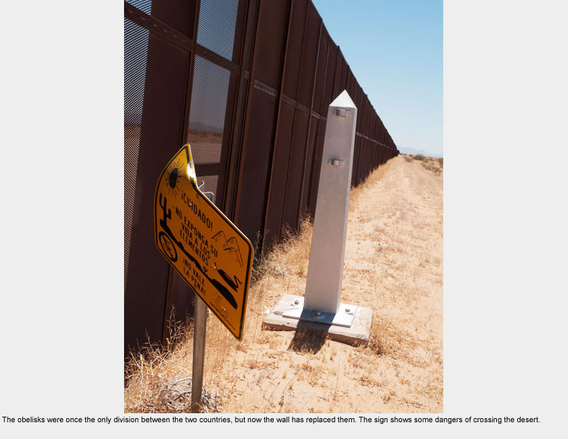
At Lukeville, Arizona and Sonoyta, Sonora, the Organ Pipe Cactus National Monument meets the bio-reserve in Mexico known as the Gran Desierto de Altar, a vast and beautiful but harsh natural area covering much of the northwestern corner of the Sonora state.
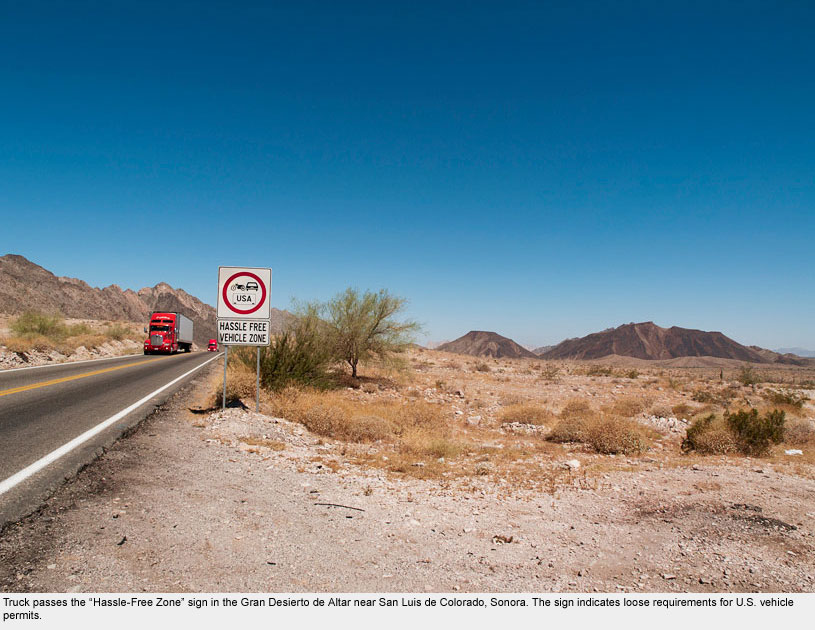
Mexican Route 2 traversing the park along the northern edge is mostly an untraveled road.
As the road nears its western end, signs boast in English that the area is a “hassle-free zone,” meaning vehicles from the U.S. and Canada can enter northern Sonora without having a vehicle permit: a public relations move meant to draw tourists.
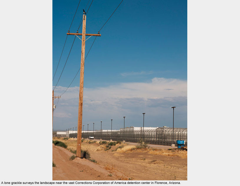
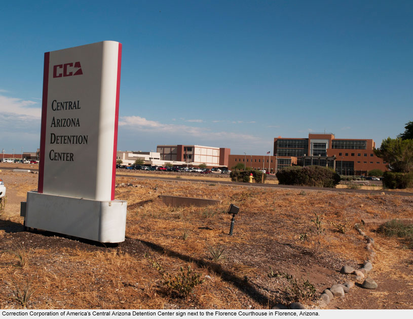
Three hours north of Lukeville lies the vast complex of the Central Arizona Detention Center run by the private company, Corrections Corporation of America (CCA) in Florence, Arizona.
CCA, in coordination with the Department of Homeland Security, has detained thousands of Mexican migrants in this facility over the last decade.
If Mexican Route 2 is a “hassle-free” zone, then the road through Florence is anything but.
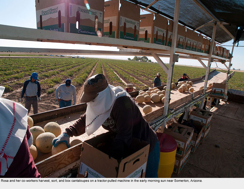
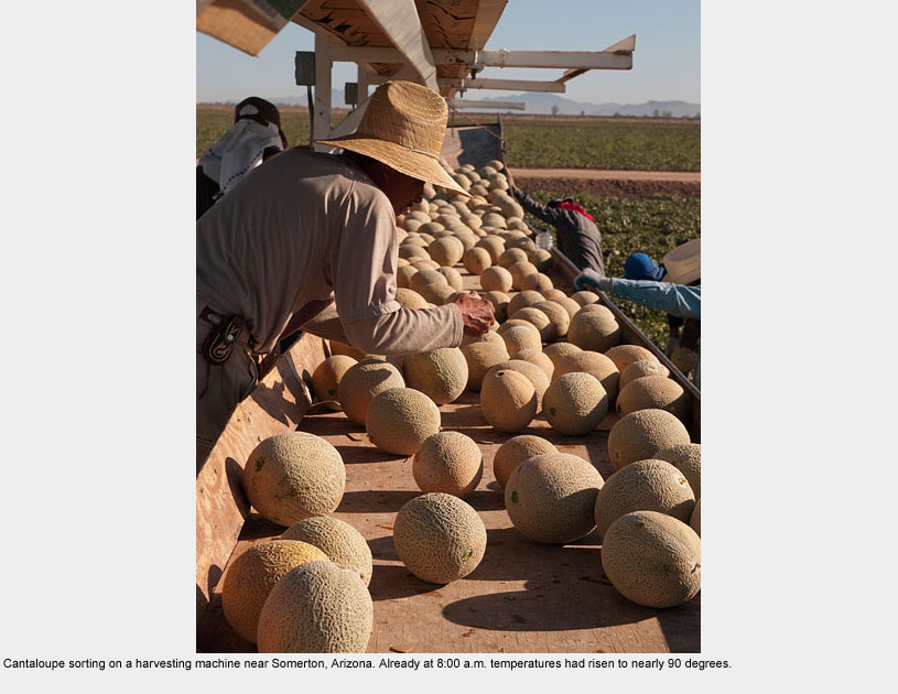
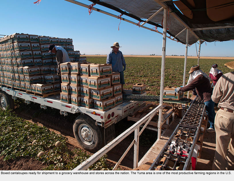
Yuma
Yuma
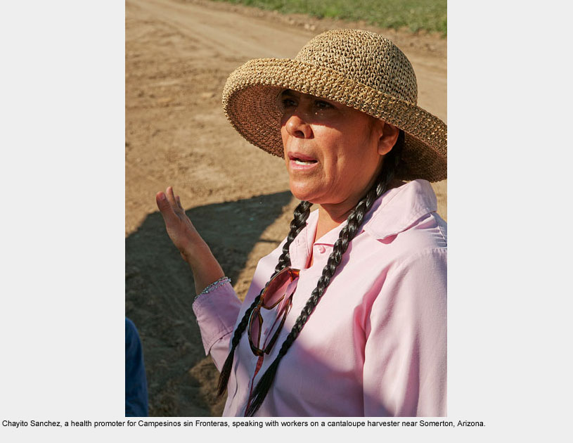
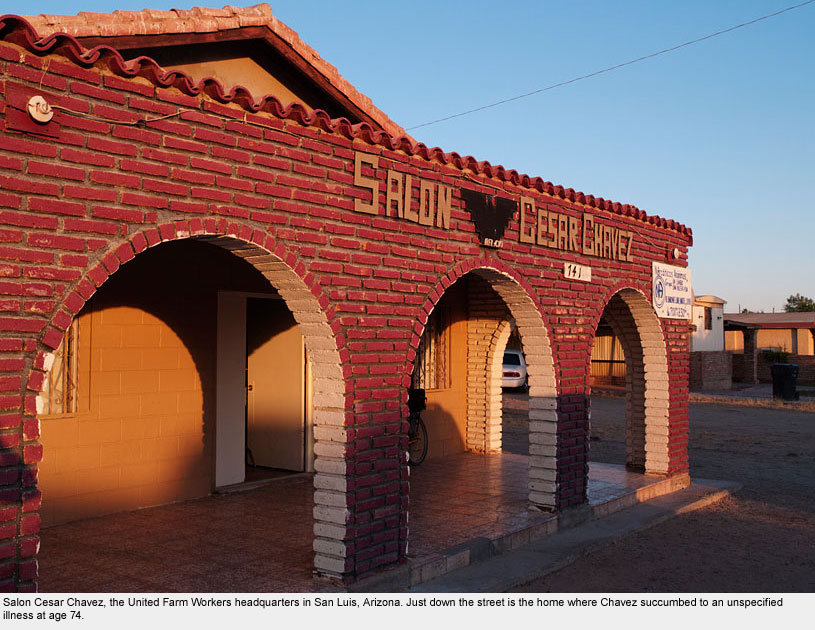
Yuma is where Cesar Chavez was born in 1927 and just ten miles from where he died in 1993. I spent a day in the Yuma area with Chayito Sanchez, an outreach worker promoting farmworker health.
She too had worked the fields and now educates others about their rights; I couldn’t help but compare this strong woman to Chavez.
She told me that her organization is the only one in Yuma that “works outside in the fields.”
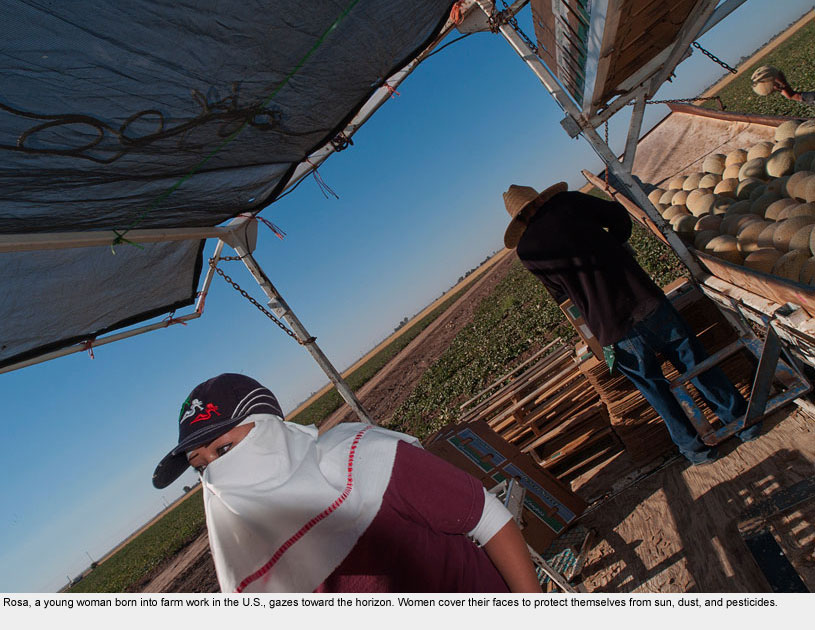
Thanks to Chayito, I was able to spend all morning on a huge melon-harvesting machine with two-dozen workers. They couldn’t have been more welcoming to me, but their smiles hid much pain.
Chayito told me that there are pregnant women and injured men working the fields today because they’re afraid of losing their jobs if they take a break. “We come as workers and we’re treated as criminals.”
The Yuma area is home to 45,000 farmworkers today. These people aren’t in some foreign country; they’re woven into the very fabric of our American agriculture.
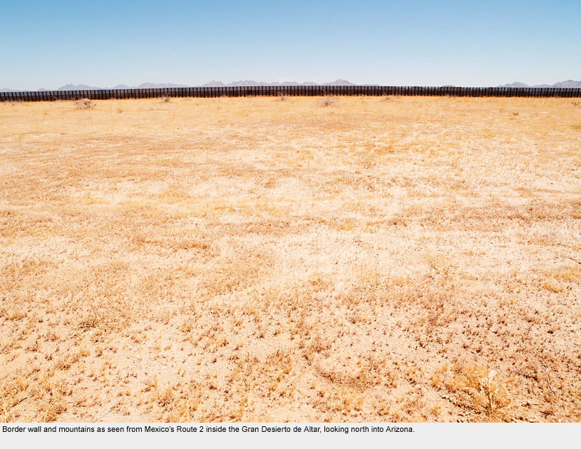
San Luis / Rio Colorado
San Luis / Rio Colorado
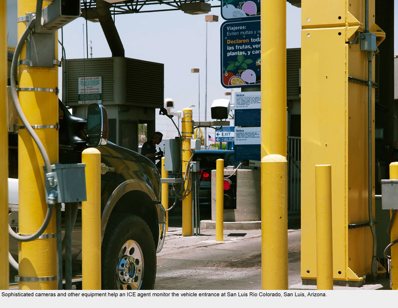
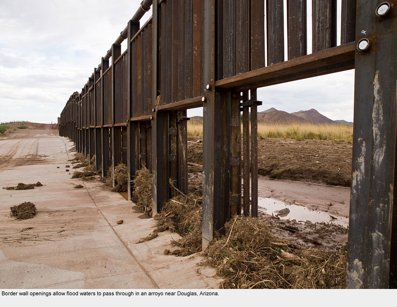
In the last twenty-five miles on the Western end of the Magdalena de Kino Road (Mexico’s Federal Highway #2), the border wall frames what was once a vast sandy flat and forces it to end artificially with a straight, dark horizon line.
Surely this barrier restricts not only the view but also migration patterns of the animals living in this harsh environment.
As I passed through the border checkpoint and into San Luis, Arizona, I realized that water made all the difference for this productive area. Melon fields and farmworkers were everywhere.
Ironically, the Mexican town of Rio Colorado is named for the river that once flowed through its territory, but now the U.S. agricultural fields suck up nearly all of the mighty river’s water before it reaches the border.
Is it any surprise that campesinos from Mexico must work in fields north of the border?
As I headed north on the main road to Yuma, a sign for the organization Campesinos sin Fronteras leapt into view.
I whipped the car into the parking lot and soon was talking with the organization’s director, Emma Torres, mostly about SB 1070.
She invited me to an information meeting for citizens about the new bill that afternoon. Her report on the situation was dire:
“I was part of the Cesar Chavez movement,” she said, “I never felt hopelessness then. Now I’m seeing despair – oppression engraved in the hearts of the young.”
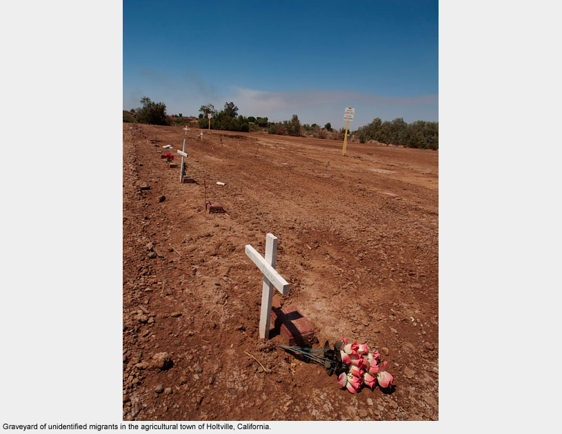
Holtville
Holtville
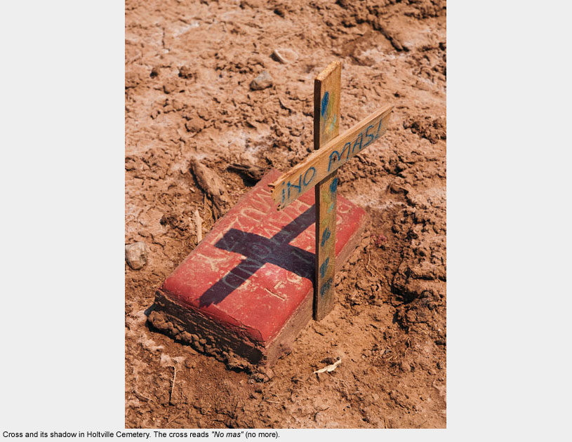
The small town of Holtville is located in the middle of Imperial Valley, California: one of the most productive agricultural areas in the country. Having read about a burial site for unidentified migrants who had died in the desert nearby, I set out to look for it.
After driving for over an hour, several cantaloupe harvesters pointed me in the direction of a small graveyard where a few shade trees and plastic flowers marked “Holtville Cemetery.”
It was fairly ordinary for a rural graveyard, except that behind the back hedge were dozens of wooden crosses planted in a barren field among piles of unwanted soil and other discards from the graves. Most of the crosses bore no names at all.
I knew that these people buried here had stories to tell. I stood among them and listened to their silence.
The signs around them read “do not enter,” that the land could cave in if one walked through. I ignored those signs.
These were the unknown soldiers of an American war at the border, a war waged mostly on the poor. Some of them had likely harvested melons or lettuce shipped to a grocery store near my home. I had to pay my respects.
Calexico / Mexicali
Calexico / Mexicali
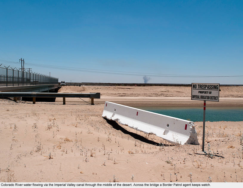
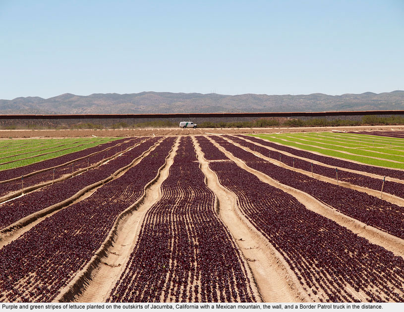
Leaving the fields of the Imperial Valley, where a billion dollar industry produces over eighty percent of the winter vegetables in the U.S., I passed through miles of arid desert near Calexico.
Water from the Colorado River runs along Interstate 8 in a concrete canal on its way to turn dry land into verdant fields.
Scenes just a mile from fertile ground looked to me as barren as the moon; only one canal filled with scarce water made the difference between green and brown.
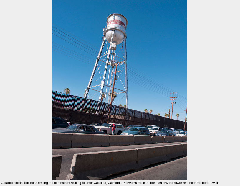
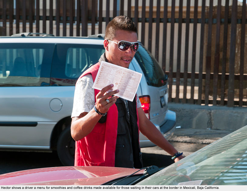
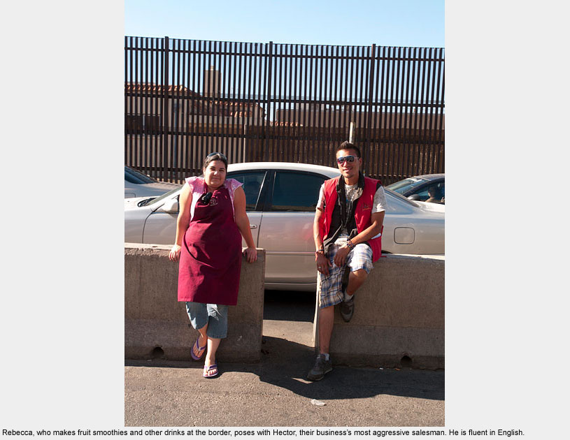
Arriving in Mexicali, I witnessed – in a microcosm – the economic interdependence the U.S. and Mexico share. Crossing the border on foot, I walked through the business district.
Nothing much for tourists here, but with thousands of commuters heading to Calexico each day, businesses had sprung up to serve them in their cars.
I spent part of the afternoon with Rebecca, Gerardo, and Hector who make and sell smoothies and coffee drinks and take orders and deliver them to drivers as they wait in traffic.
Hector told me how much he longed to work again in the United States. “If I can work here and make money, I’ll have enough to go back. I have young children in California,” he said.
Jacumba
Jacumba
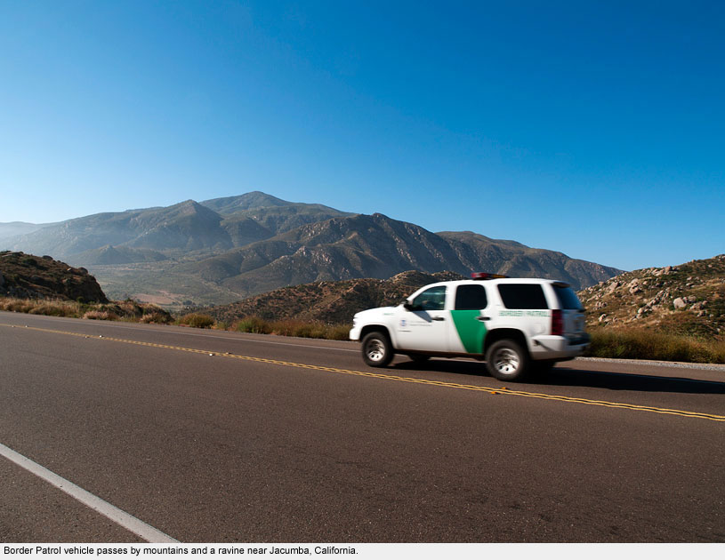
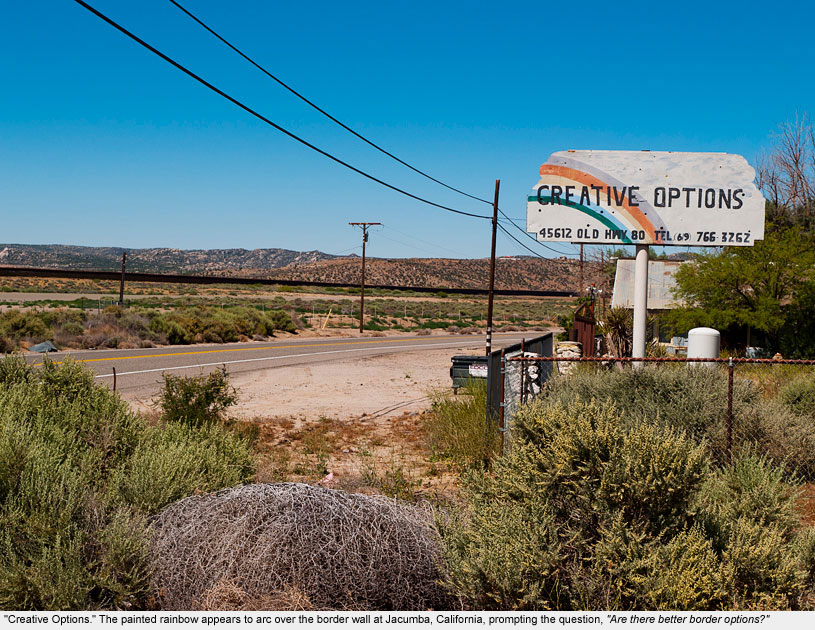
In this mountain desert town once well known for its hot springs, the landscape is its prominent defining characteristic. Traditionally, there were almost no conspicuous manmade structures here.
With the passage of the Secure Fence Act of 2006 during the George W. Bush Administration came the border wall, more Border Patrol vehicles, and roads made for patrolling along the wall.
Now the wall cuts through the town, scarring the landscape with a stark line.
Route 80, the road that leads through Jacumba was once the main route to the Pacific.
Today, Interstate 8 (just 2 miles away from Route 80) has all but condemned the old route to history. Except, of course, for the fact that Route 80 is used every day by dozens of Border Patrollers.
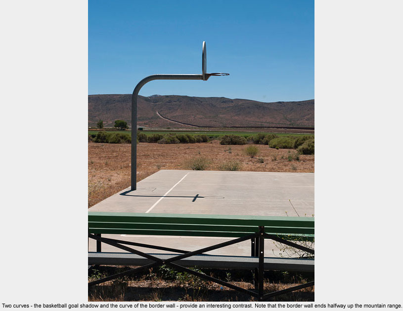
Tecate / Tecate
Tecate / Tecate
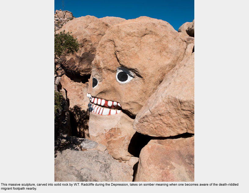
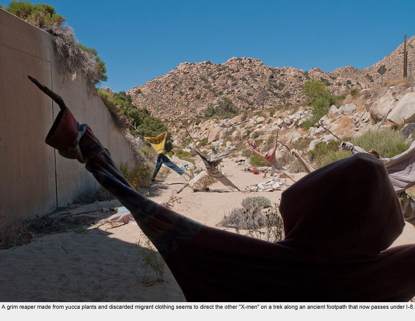
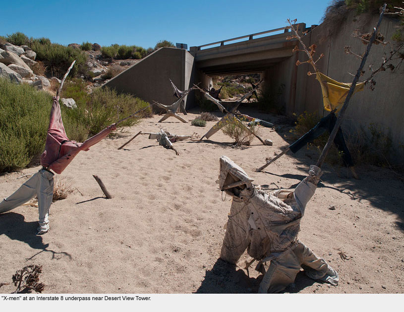
At the southern tip of the Anza Borrego Desert, Interstate 8 winds up the arid In-Ko-Pah Mountain range. Sitting atop the crest overlooking the valley is Desert View Tower, only a stone’s throw from the highway.
The tower, built in 1922, is a privately owned tourist attraction featuring 100-mile views, a museum, and massive stone sculptures carved during the Depression by an out-of-work engineer, W.T. Radcliffe.
A short walk down the gorge from the tower is a ravine that runs under the highway where a local man has created an army of “X-men” using stalks of yucca plants and discarded clothing left behind by migrants from Mexico.
Today, these migrants use the same ancient route that the In-Ko-Pah and other indigenous peoples once traveled on expeditions to the Pacific. Nearby is a hiding place where the Border Patrol officers park their trucks, waiting to capture the unsuspecting ones.
Migrant footprints and discarded clothing are all that remain to tell of broken dreams and fragmented journeys.
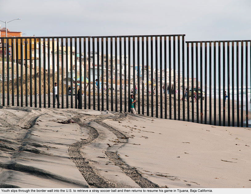
Tijuana / Imperial Beach
Tijuana / Imperial Beach
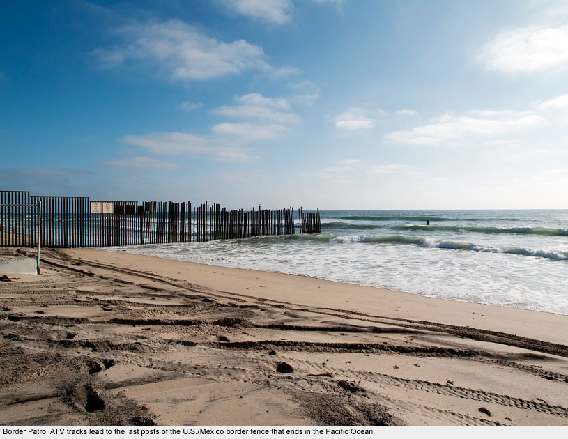
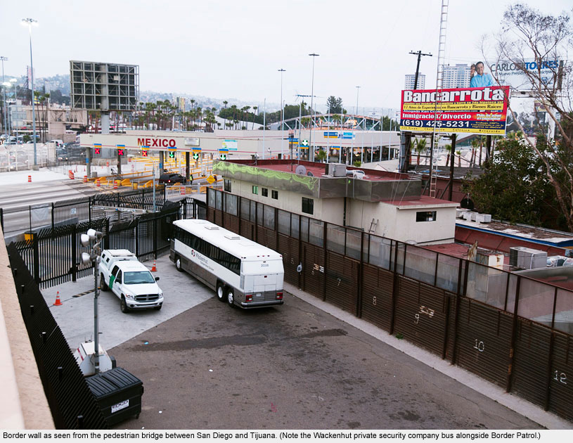
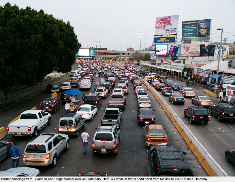
1,969 miles from Boca Chica, Texas, the western end of the border wall culminates in the Pacific Ocean at the major international metropolitan area of Tijuana and San Diego.
Tijuana is Mexico’s fifth largest city, and the combined population of the international region is over 5 million. More than 300,000 legal border crossings occur here at San Ysidro every day.
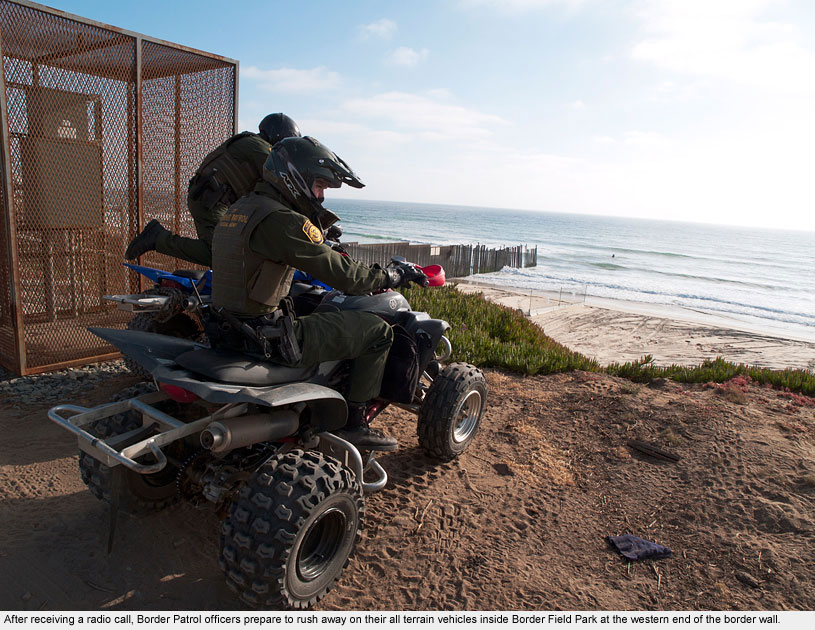
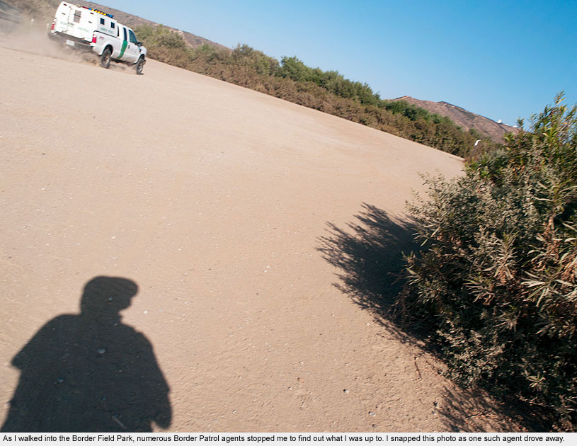
I searched for over an hour before finding the entrance to the nearly defunct Border Field State Park that is home to the end of the border wall. The site is closed to public vehicle traffic and now crawls with Border Patrol trucks and ATVs.
I finally found my way into the park on foot, on the very day in 2010 when Mexico beat France in the World Cup. Bands played in Mexico, people sang and shouted, and hundreds played on the beach.
Meanwhile, the U.S. side of the border was empty, except for the men in green.
At one point while I was conversing with Border Patrol officers, an urgent radio call came in. They jumped on their ATVs and were gone in seconds.
Less than a minute after they had departed, a young man in Mexico slipped through the fence into the U.S. to retrieve a stray soccer ball and just as quickly went back into Mexico.